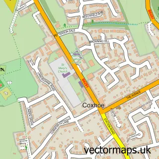
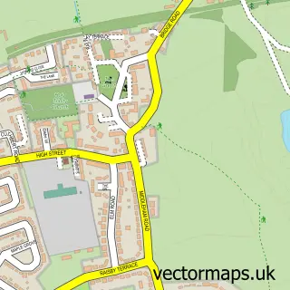
This Parkhill street map is a detailed vector street map covering a 750m x 750m area. Select a larger area to create and download your own vector street map of Parkhill.
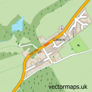
The 750-metre map sample for Parkhill covers 258 mapped buildings and approximately 9.8 km of road detail, of which 6 named roads are named. The immediate area includes 3 GP surgeries within 2 miles and 1 MOT station, with 6 within 2 miles. To create a larger or custom map of Parkhill, the map builder lets you define your own coverage area and download editable SVG, PDF and PNG files.
Create a larger editable map of Parkhill
Choose any area you need and generate a high-quality vector map instantly. Perfect for print, planning, design, business and personal use.

This Parkhill street map in Durham is available as downloadable SVG, PDF and PNG map files, or as a printed map for planning, business, display, education, local information and design work. You can also create a larger custom map area using the map selector.
What this Parkhill map sample shows
Parkhill lies within Cassop-Cum-Quarrington Cp parish, part of Coxhoe ward in the County Durham local authority area. The postcode geography for this area includes the DH postcode area, the DH6 postcode district and the DH6 5 postcode sector. Residents fall under the Nhs North East And North Cumbria Integrated Care Board for NHS services.
Local features near Parkhill
Within 2 milesAmenities and services in and around Parkhill.
Administrative and postcode information for Parkhill
Parkhill lies within Cassop-Cum-Quarrington Cp parish, part of Coxhoe ward in the County Durham local authority area. The postcode geography for this area includes the DH postcode area, the DH6 postcode district and the DH6 5 postcode sector. Residents fall under the Nhs North East And North Cumbria Integrated Care Board for NHS services.
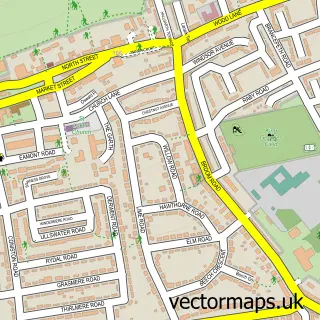
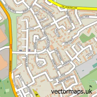
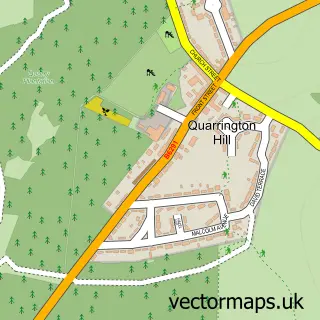
Nearby street map samples around Parkhill

More street maps in Durham
750 metre map area coverage
Boundary, postcode and point of interest information for the 750m x 750m rectangle centred on this sample map.
Boundaries containing map centre
Constituency: Newton Aycliffe and Spennymoor Co Const
District: County Durham
Icb: NHS North East and North Cumbria ICB
Parish: Cassop-cum-Quarrington CP
Police Force: durham
Postcode District: DH6
Postcode Sector: DH6 4
Nearby boundaries intersecting sample
Parish: Coxhoe CP
Postcode Sector: DH6 5
Postcode coverage
POI category counts
Automotive Repair: 1
Beach: 1
Construction Services: 1
Convenience Store: 1
Courier And Delivery Services: 1
Driving School: 1
Event Technology Service: 1
Gastropub: 1
Home Service: 1
Italian Restaurant: 1
Sample points of interest
- Clarence Villa Service Station
- Blackhall Beach
- D&T Stone Masonry
- Parkhill shop
- Evri ParcelShop
- Andy Lynn Driving Instructor
- Hilights Entertainment
- The Italian Farmhouse Coxhoe
- Shining Stars Nursery
- Farmhouse Dine & Wine
- New Level Landscapes
- New Level Landscapes Ltd
Create a larger editable map of Parkhill
This sample shows only a 750 metre area. To create a larger map of Parkhill, use our map builder to choose your own coverage area, add titles and download editable SVG, PDF and PNG files.
Create a custom map of Parkhill