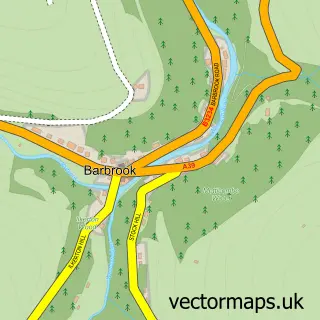
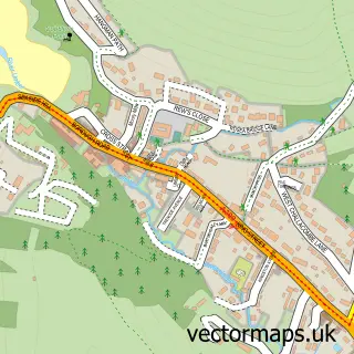
This Parracombe street map is a detailed vector street map covering a 750m x 750m area. Select a larger area to create and download your own vector street map of Parracombe.
The 750-metre map sample for Parracombe covers 97 mapped buildings and approximately 7.9 km of road detail, of which 6 named roads are named. The immediate area includes 1 school and 1 pub. The wider area around Parracombe features 2 food and drink venues and 1 campsite within 2 miles. To create a larger or custom map of Parracombe, the map builder lets you define your own coverage area and download editable SVG, PDF and PNG files.
Create a larger editable map of Parracombe
Choose any area you need and generate a high-quality vector map instantly. Perfect for print, planning, design, business and personal use.

This Parracombe street map in Devon is available as downloadable SVG, PDF and PNG map files, or as a printed map for planning, business, display, education, local information and design work. You can also create a larger custom map area using the map selector.
What this Parracombe map sample shows
Parracombe lies within Parracombe Cp parish, part of Lynton & Lynmouth ward in the North Devon District local authority area. The postcode geography for this area includes the EX postcode area, the EX31 postcode district and the EX31 4 postcode sector. Residents fall under the Nhs Devon Integrated Care Board for NHS services.
Local features near Parracombe
Within 2 milesAmenities and services in and around Parracombe.
Administrative and postcode information for Parracombe
The local authority covering Parracombe is North Devon District, within the county of Devon. The settlement lies within Lynton & Lynmouth ward and Parracombe Cp civil parish. The EX31 postcode district and EX31 4 postcode sector serve the immediate area. NHS provision in the area is delivered through Northern Devon Nhs Trust.
Nearby street map samples around Parracombe

More street maps in Devon
750 metre map area coverage
Boundary, postcode and point of interest information for the 750m x 750m rectangle centred on this sample map.
Boundaries containing map centre
Constituency: North Devon Co Const
County: Devon County
District: North Devon District
Icb: NHS Devon ICB
Parish: Parracombe CP
Police Force: devon and cornwall
Postcode District: EX31
Postcode Sector: EX31 4
Ward: Lynton & Lynmouth Ward
Nearby boundaries intersecting sample
No additional intersecting boundaries found.
Postcode coverage
POI category counts
Active Life: 1
Bed And Breakfast: 1
Cafe: 1
Chimney Sweep: 1
Church Cathedral: 1
Convenience Store: 1
Elementary School: 1
Energy Equipment And Solution: 1
Farm: 1
Forestry Service: 1
Sample points of interest
- Dean Riding Stables
- Highfield House B&B
- Pavilion Stores and Café
- Journeyman Chimney Services
- Christ Church Parracombe
- Parracombe Post Office
- Parracombe Church of England Primary School
- Eco Exmoor Ltd.
- Holwill Charolais
- Woolhanger Farming Partnership
- The Fox and Goose
Create a larger editable map of Parracombe
This sample shows only a 750 metre area. To create a larger map of Parracombe, use our map builder to choose your own coverage area, add titles and download editable SVG, PDF and PNG files.
Create a custom map of Parracombe