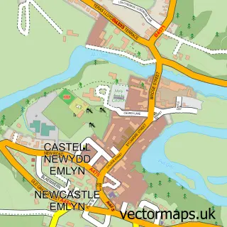
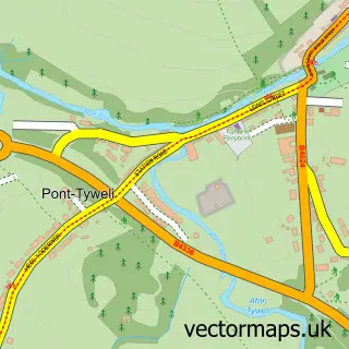
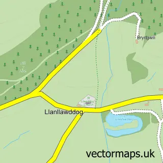
This Pencader street map is a detailed vector street map covering a 750m x 750m area. Select a larger area to create and download your own vector street map of Pencader.
The 750-metre map sample for Pencader covers 179 mapped buildings and approximately 7.3 km of road detail, of which 6 named roads are named. The immediate area includes 1 school and 1 MOT station within 2 miles. The wider area around Pencader features 1 tourism point of interest. To create a larger or custom map of Pencader, the map builder lets you define your own coverage area and download editable SVG, PDF and PNG files.
Create a larger editable map of Pencader
Choose any area you need and generate a high-quality vector map instantly. Perfect for print, planning, design, business and personal use.

This Pencader street map in Dyfed is available as downloadable SVG, PDF and PNG map files, or as a printed map for planning, business, display, education, local information and design work. You can also create a larger custom map area using the map selector.
What this Pencader map sample shows
Pencader lies within Llanfihangel-Ar-Arth Community parish, part of Llanfihangel-Ar-Arth ward in the Sir Gaerfyrddin - Carmarthenshire local authority area. The postcode geography for this area includes the SA postcode area, the SA39 postcode district and the SA39 9 postcode sector. Residents fall under the Hywel Dda University Health Board for NHS services.
Local features near Pencader
Within 2 milesAmenities and services in and around Pencader.
Administrative and postcode information for Pencader
Pencader lies within Llanfihangel-Ar-Arth Community parish, part of Llanfihangel-Ar-Arth ward in the Sir Gaerfyrddin - Carmarthenshire local authority area. The postcode geography for this area includes the SA postcode area, the SA39 postcode district and the SA39 9 postcode sector. Residents fall under the Hywel Dda University Health Board for NHS services.
Nearby street map samples around Pencader

More street maps in Dyfed
750 metre map area coverage
Boundary, postcode and point of interest information for the 750m x 750m rectangle centred on this sample map.
Boundaries containing map centre
Constituency: Caerfyrddin Co Const
District: Sir Gaerfyrddin - Carmarthenshire
Icb: Hywel Dda
Parish: Llanfihangel-ar-Arth Community
Police Force: dyfed-powys
Postcode District: SA39
Postcode Sector: SA39 9
Nearby boundaries intersecting sample
No additional intersecting boundaries found.
Postcode coverage
POI category counts
Convenience Store: 3
Building Supply Store: 2
Antique Store: 1
Beauty Salon: 1
Bed And Breakfast: 1
Credit Union: 1
Energy Equipment And Solution: 1
Fish And Chips Restaurant: 1
Furniture Store: 1
Hair Salon: 1
Sample points of interest
- Oakgrove antiques centre
- Sue's Hair Stylist & Treatment Room
- The School House B&B
- Old School Joinery
- Plumbers Electricians Carpenters
- Morrisons Daily
- Pencader stores
- Premier Local Bargains
- SaveEasy Credit Union
- Solarcymru Ltd.
- Branney's Pencader Chip Shop
- Speedy Sofas Wales
Create a larger editable map of Pencader
This sample shows only a 750 metre area. To create a larger map of Pencader, use our map builder to choose your own coverage area, add titles and download editable SVG, PDF and PNG files.
Create a custom map of Pencader