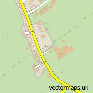
This Pooley Bridge street map is a detailed vector street map covering a 750m x 750m area. Select a larger area to create and download your own vector street map of Pooley Bridge.
The 750-metre map sample for Pooley Bridge covers 81 mapped buildings and approximately 6.6 km of road detail, of which 5 named roads are named. The immediate area includes 2 pubs. The wider area around Pooley Bridge features 4 tourism points of interest, 5 food and drink venues and 4 hotels. To create a larger or custom map of Pooley Bridge, the map builder lets you define your own coverage area and download editable SVG, PDF and PNG files.
Create a larger editable map of Pooley Bridge
Choose any area you need and generate a high-quality vector map instantly. Perfect for print, planning, design, business and personal use.

This Pooley Bridge street map in Cumbria is available as downloadable SVG, PDF and PNG map files, or as a printed map for planning, business, display, education, local information and design work. You can also create a larger custom map area using the map selector.
What this Pooley Bridge map sample shows
Pooley Bridge lies within Barton And Pooley Bridge Cp parish, part of Askham ward in the Westmorland And Furness local authority area. The postcode geography for this area includes the CA postcode area, the CA10 postcode district and the CA10 2 postcode sector. Residents fall under the Nhs North East And North Cumbria Integrated Care Board for NHS services.
Local features near Pooley Bridge
Within 2 milesAmenities and services in and around Pooley Bridge.
Administrative and postcode information for Pooley Bridge
Pooley Bridge lies within Barton And Pooley Bridge Cp parish, part of Askham ward in the Westmorland And Furness local authority area. The postcode geography for this area includes the CA postcode area, the CA10 postcode district and the CA10 2 postcode sector. Residents fall under the Nhs North East And North Cumbria Integrated Care Board for NHS services.
Nearby street map samples around Pooley Bridge

More street maps in Cumbria
750 metre map area coverage
Boundary, postcode and point of interest information for the 750m x 750m rectangle centred on this sample map.
Boundaries containing map centre
Constituency: Westmorland and Lonsdale Co Const
District: Westmorland and Furness
Icb: NHS North East and North Cumbria ICB
Parish: Barton and Pooley Bridge CP
Police Force: cumbria
Postcode District: CA10
Postcode Sector: CA10 2
Ward: Eamont and Shap Ward
Nearby boundaries intersecting sample
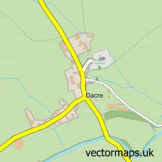
Parish: Dacre CP
Postcode District: CA11
Postcode Sector: CA11 0
Ward: Greystoke and Ullswater Ward
Postcode coverage
POI category counts
Hotel: 4
Lake: 3
Convenience Store: 2
Cottage: 2
Landmark And Historical Building: 2
Pub: 2
Restaurant: 2
Anglican Church: 1
Bed And Breakfast: 1
Bistro: 1
Sample points of interest
- St Paul
- 1863 Restaurant with Rooms
- 1863 Bar/Restaurant
- Lakeland Boat Hire
- Lakeland Boat Hire
- Verey Books
- Granny Dowbekin's Cafe & Restaurant
- Waterside House Camp Site
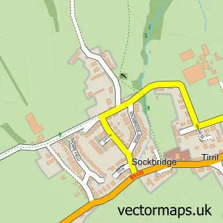
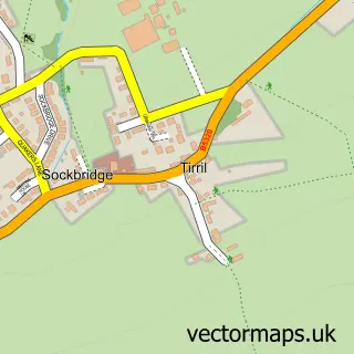
- Sockbridge and Tirril
- Lowther Mini Market
- Pooley Bridge Post Office
- Barton Hall Farm Holiday Cottages
Create a larger editable map of Pooley Bridge
This sample shows only a 750 metre area. To create a larger map of Pooley Bridge, use our map builder to choose your own coverage area, add titles and download editable SVG, PDF and PNG files.
Create a custom map of Pooley Bridge