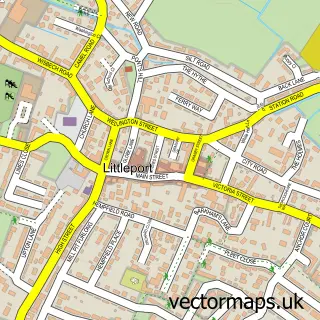
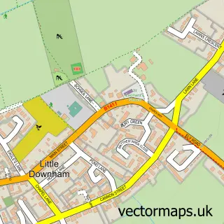
This Queen Adelaide street map is a detailed vector street map covering a 750m x 750m area. Select a larger area to create and download your own vector street map of Queen Adelaide.
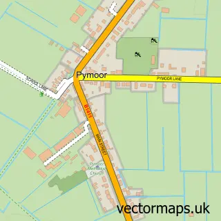
The 750-metre map sample for Queen Adelaide covers 85 mapped buildings and approximately 10.1 km of road detail, of which 5 named roads are named. The immediate area includes 2 GP surgeries within 2 miles and 1 MOT station, with 7 within 2 miles. The wider area around Queen Adelaide features 1 tourism point of interest. To create a larger or custom map of Queen Adelaide, the map builder lets you define your own coverage area and download editable SVG, PDF and PNG files.
Create a larger editable map of Queen Adelaide
Choose any area you need and generate a high-quality vector map instantly. Perfect for print, planning, design, business and personal use.

This Queen Adelaide street map in Cambridgeshire is available as downloadable SVG, PDF and PNG map files, or as a printed map for planning, business, display, education, local information and design work. You can also create a larger custom map area using the map selector.
What this Queen Adelaide map sample shows
Queen Adelaide lies within Ely Cp parish, part of Ely North ward in the East Cambridgeshire District local authority area. The postcode geography for this area includes the CB postcode area, the CB7 postcode district and the CB7 4 postcode sector. Residents fall under the Nhs Cambridgeshire And Peterborough Integrated Care Board for NHS services.
Local features near Queen Adelaide
Within 2 milesAmenities and services in and around Queen Adelaide.
Administrative and postcode information for Queen Adelaide
Queen Adelaide lies within Ely Cp parish, part of Ely North ward in the East Cambridgeshire District local authority area. The postcode geography for this area includes the CB postcode area, the CB7 postcode district and the CB7 4 postcode sector. Residents fall under the Nhs Cambridgeshire And Peterborough Integrated Care Board for NHS services.
Nearby street map samples around Queen Adelaide

More street maps in Cambridgeshire
750 metre map area coverage
Boundary, postcode and point of interest information for the 750m x 750m rectangle centred on this sample map.
Boundaries containing map centre
Constituency: Ely and East Cambridgeshire Co Const
County: Cambridgeshire County
District: East Cambridgeshire District
Icb: NHS Central East ICB
Parish: Ely CP
Police Force: cambridgeshire
Postcode District: CB7
Postcode Sector: CB7 4
Ward: Ely North Ward
Nearby boundaries intersecting sample
No additional intersecting boundaries found.
Postcode coverage
POI category counts
Pet Groomer: 2
Automotive Repair: 1
Car Dealer: 1
Industrial Company: 1
Landmark And Historical Building: 1
Real Estate Agent: 1
Scout Hall: 1
Tire Shop: 1
Sample points of interest
- Queen Adelaide Garage
- Auto Miraj UK - Queen Adelaide Garage
- PW Construction Anglia Ltd
- Queen Adelaide, Cambridgeshire
- Elaines Dog and Cat Grooming
- The Dog Bathing company
- C E Power
- 2nd Ely (St.Marys)
- Ely Motor Services
Create a larger editable map of Queen Adelaide
This sample shows only a 750 metre area. To create a larger map of Queen Adelaide, use our map builder to choose your own coverage area, add titles and download editable SVG, PDF and PNG files.
Create a custom map of Queen Adelaide