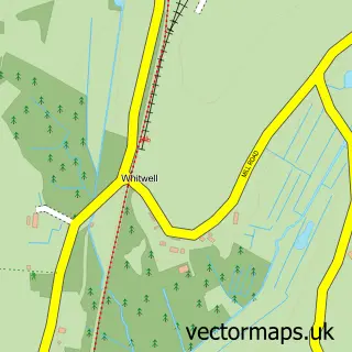
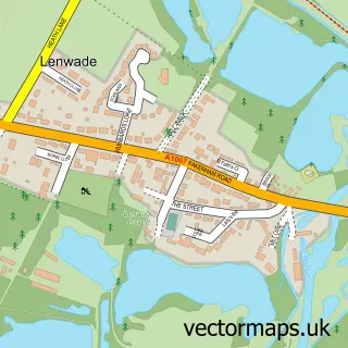
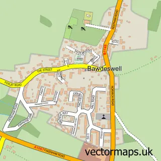
This Reepham street map is a detailed vector street map covering a 750m x 750m area. Select a larger area to create and download your own vector street map of Reepham.
The 750-metre map sample for Reepham covers 410 mapped buildings and approximately 14.0 km of road detail, of which 31 named roads are named. The immediate area includes 1 school, 1 GP surgery, 1 pub and 2 MOT stations within 2 miles. The wider area around Reepham features 1 tourism point of interest, 3 food and drink venues and 1 hotel. To create a larger or custom map of Reepham, the map builder lets you define your own coverage area and download editable SVG, PDF and PNG files.
Create a larger editable map of Reepham
Choose any area you need and generate a high-quality vector map instantly. Perfect for print, planning, design, business and personal use.

This Reepham street map in Norfolk is available as downloadable SVG, PDF and PNG map files, or as a printed map for planning, business, display, education, local information and design work. You can also create a larger custom map area using the map selector.
What this Reepham map sample shows
Reepham lies within Reepham Cp parish, part of Reepham ward in the Broadland District local authority area. The postcode geography for this area includes the NR postcode area, the NR10 postcode district and the NR10 4 postcode sector. Residents fall under the Nhs Norfolk And Waveney Integrated Care Board for NHS services.
Local features near Reepham
Within 2 milesAmenities and services in and around Reepham.
Administrative and postcode information for Reepham
The local authority covering Reepham is Broadland District, within the county of Norfolk. The settlement lies within Reepham ward and Reepham Cp civil parish. The NR10 postcode district and NR10 4 postcode sector serve the immediate area. NHS provision in the area is delivered through Norfolk And Norwich University Hospitals Nhs Foundation Trust.
Nearby street map samples around Reepham

More street maps in Norfolk
750 metre map area coverage
Boundary, postcode and point of interest information for the 750m x 750m rectangle centred on this sample map.
Boundaries containing map centre
Constituency: Broadland and Fakenham Co Const
County: Norfolk County
District: Broadland District
Icb: NHS Norfolk and Waveney ICB
Parish: Reepham CP
Police Force: norfolk
Postcode District: NR10
Postcode Sector: NR10 4
Ward: Reepham Ward
Nearby boundaries intersecting sample
No additional intersecting boundaries found.
Postcode coverage
POI category counts
Flowers And Gifts Shop: 5
Hair Salon: 4
Antique Store: 3
Beauty Salon: 3
Convenience Store: 3
Holiday Rental Home: 3
Advertising Agency: 2
Anglican Church: 2
Art Gallery: 2
Bed And Breakfast: 2
Sample points of interest
- Hotbrand
- Johnson Design
- Louisa Dreisin MA, LCPH, MARH, RHom, HbT
- Reepham: St Mary
- Whitwell: St Michael & All Angels
- Butler and Castell
- Reepham Antiques
- Rococo Loco
- Daniel Good Rare Books
- Number 21
- Wherry Housing Association
- HSBC Bank
Create a larger editable map of Reepham
This sample shows only a 750 metre area. To create a larger map of Reepham, use our map builder to choose your own coverage area, add titles and download editable SVG, PDF and PNG files.
Create a custom map of Reepham