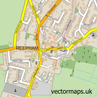
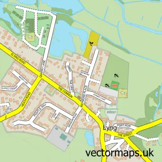
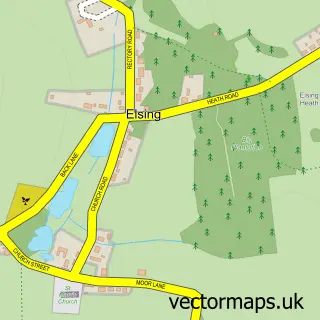
This Lenwade street map is a detailed vector street map covering a 750m x 750m area. Select a larger area to create and download your own vector street map of Lenwade.
The 750-metre map sample for Lenwade covers 197 mapped buildings and approximately 6.3 km of road detail, of which 13 named roads are named. The immediate area includes 1 school, 1 pub and 2 MOT stations within 2 miles. The wider area around Lenwade features 1 tourism point of interest and 1 food and drink venue. To create a larger or custom map of Lenwade, the map builder lets you define your own coverage area and download editable SVG, PDF and PNG files.
Create a larger editable map of Lenwade
Choose any area you need and generate a high-quality vector map instantly. Perfect for print, planning, design, business and personal use.

This Lenwade street map in Norfolk is available as downloadable SVG, PDF and PNG map files, or as a printed map for planning, business, display, education, local information and design work. You can also create a larger custom map area using the map selector.
What this Lenwade map sample shows
Lenwade lies within Great Witchingham Cp parish, part of Great Witchingham ward in the Broadland District local authority area. The postcode geography for this area includes the NR postcode area, the NR9 postcode district and the NR9 5 postcode sector. Residents fall under the Nhs Norfolk And Waveney Integrated Care Board for NHS services.
Local features near Lenwade
Within 2 milesAmenities and services in and around Lenwade.
Administrative and postcode information for Lenwade
The local authority covering Lenwade is Broadland District, within the county of Norfolk. The settlement lies within Great Witchingham ward and Great Witchingham Cp civil parish. The NR9 postcode district and NR9 5 postcode sector serve the immediate area. NHS provision in the area is delivered through Norfolk And Norwich University Hospitals Nhs Foundation Trust.
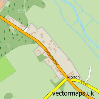
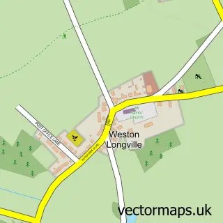
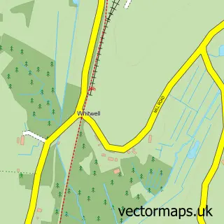
Nearby street map samples around Lenwade

More street maps in Norfolk
750 metre map area coverage
Boundary, postcode and point of interest information for the 750m x 750m rectangle centred on this sample map.
Boundaries containing map centre
Constituency: Broadland and Fakenham Co Const
County: Norfolk County
District: Broadland District
Icb: NHS Norfolk and Waveney ICB
Parish: Great Witchingham CP
Police Force: norfolk
Postcode District: NR9
Postcode Sector: NR9 5
Ward: Great Witchingham Ward
Nearby boundaries intersecting sample
Parish: Weston Longville CP
Postcode coverage
POI category counts
Contractor: 2
Automotive Repair: 1
Bakery: 1
Bar: 1
Barber: 1
Butcher Shop: 1
Community Center: 1
Convenience Store: 1
Dog Walkers: 1
Event Photography: 1
Sample points of interest
- Johnsons Garage
- Kellys Bakery
- The Bridge Inn
- Cuts at No.4
- Len Wade Butchers
- Great Witchingham Village Hall
- R J Crane Hire
- Shepherds Demolition
- Budgens BUDGENS - LENWADE
- Good Dog Pet Care Services
- Norfolk Film & Video Transfers
- PW Bookkeeping Services
Create a larger editable map of Lenwade
This sample shows only a 750 metre area. To create a larger map of Lenwade, use our map builder to choose your own coverage area, add titles and download editable SVG, PDF and PNG files.
Create a custom map of Lenwade