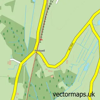
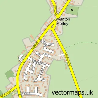
This Lyng street map is a detailed vector street map covering a 750m x 750m area. Select a larger area to create and download your own vector street map of Lyng.
The 750-metre map sample for Lyng covers 307 mapped buildings and approximately 11.8 km of road detail, of which 18 named roads are named. The immediate area includes 1 school, 1 pub and 1 MOT station. The wider area around Lyng features 3 tourism points of interest, 1 food and drink venue and 1 hotel. To create a larger or custom map of Lyng, the map builder lets you define your own coverage area and download editable SVG, PDF and PNG files.
Create a larger editable map of Lyng
Choose any area you need and generate a high-quality vector map instantly. Perfect for print, planning, design, business and personal use.

This Lyng street map in Norfolk is available as downloadable SVG, PDF and PNG map files, or as a printed map for planning, business, display, education, local information and design work. You can also create a larger custom map area using the map selector.
What this Lyng map sample shows
Lyng lies within Lyng Cp parish, part of Upper Wensum ward in the Breckland District local authority area. The postcode geography for this area includes the NR postcode area, the NR9 postcode district and the NR9 5 postcode sector. Residents fall under the Nhs Norfolk And Waveney Integrated Care Board for NHS services.
Local features near Lyng
Within 2 milesAmenities and services in and around Lyng.
Administrative and postcode information for Lyng
Lyng lies within Lyng Cp parish, part of Upper Wensum ward in the Breckland District local authority area. The postcode geography for this area includes the NR postcode area, the NR9 postcode district and the NR9 5 postcode sector. Residents fall under the Nhs Norfolk And Waveney Integrated Care Board for NHS services.
Nearby street map samples around Lyng

More street maps in Norfolk
750 metre map area coverage
Boundary, postcode and point of interest information for the 750m x 750m rectangle centred on this sample map.
Boundaries containing map centre
Constituency: Mid Norfolk Co Const
County: Norfolk County
District: Breckland District
Icb: NHS Norfolk and Waveney ICB
Parish: Lyng CP
Police Force: norfolk
Postcode District: NR9
Postcode Sector: NR9 5
Ward: Upper Wensum Ward
Nearby boundaries intersecting sample
Parish: Sparham CP
Postcode coverage
POI category counts
Campground: 2
Elementary School: 2
Anglican Church: 1
Bed And Breakfast: 1
Building Supply Store: 1
Church Cathedral: 1
Convenience Store: 1
Dog Trainer: 1
Dog Walkers: 1
Driving School: 1
Sample points of interest
- Lyng: St Margaret
- The Old Ale House
- Hamilton & Co
- Utopia Nature Reserve Lyng
- Utopia Paradise Caravan Park
- St Margaret's Church
- Lyng Stores & Tea Room
- Pawfect Pets Dog Training
- Sofias Dogwalkers
- Ability Driver Training
- Lyng Church of England Primary School
- Wensum Valley Nursery School
Create a larger editable map of Lyng
This sample shows only a 750 metre area. To create a larger map of Lyng, use our map builder to choose your own coverage area, add titles and download editable SVG, PDF and PNG files.
Create a custom map of Lyng