Vector Maps logo
Home Why it works Popular maps Districts Samples Customizer Create Your Map
VectorMaps.uk
Home Popular maps Districts Samples Customizer Create Your Map Privacy Disclaimer
Home / UK Maps / North Yorkshire / Rillington Map

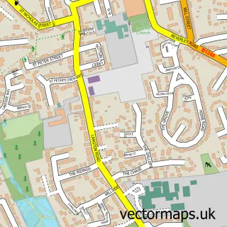
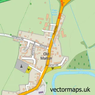
This Rillington street map is a detailed vector street map covering a 750m x 750m area. Select a larger area to create and download your own vector street map of Rillington.

Rillington is a village in North Yorkshire, in the Yorkshire And The Humber of England. Historically, the area formed part of Yorkshire. The settlement falls within the Thirsk And Malton parliamentary constituency. It is served by the YO17 postcode distri

The 750-metre map sample for Rillington covers 428 mapped buildings and approximately 11.3 km of road detail, of which 21 named roads are named. The immediate area includes 1 school, 2 pubs and 1 MOT station. The wider area around Rillington features 2 food and drink venues. To create a larger or custom map of Rillington, the map builder lets you define your own coverage area and download editable SVG, PDF and PNG files.

428Buildings
11.28 kmRoads
21Named roads
893Residents within 2 miles
Create your own

Create a larger editable map of Rillington

Choose any area you need and generate a high-quality vector map instantly. Perfect for print, planning, design, business and personal use.

Choose any location
Editable SVG files
Any size up to A0
PDF, PNG & more
Instant download
High quality guaranteed
Create My Custom Map
Secure, private & no credit card required
Rillington Vector Street Map
750m Sample
Rillington vector street map sample showing roads, buildings and local features in a 750 metre preview area
Buy Rillington Map Print from £12.95 Buy Rillington Digital Map from £6

This Rillington street map in North Yorkshire is available as downloadable SVG, PDF and PNG map files, or as a printed map for planning, business, display, education, local information and design work. You can also create a larger custom map area using the map selector.

What this Rillington map sample shows

Rillington lies within Rillington Cp parish, part of Rillington ward in the North Yorkshire local authority area. The postcode geography for this area includes the YO postcode area, the YO17 postcode district and the YO17 8 postcode sector. Residents fall under the Nhs Humber And North Yorkshire Integrated Care Board for NHS services.

Local features near Rillington

Within 2 miles

Amenities and services in and around Rillington.

1 Schools
1 MOT stations 1 within 2 miles
2 Food & drink
2 Pubs
1 Healthcare POIs
2 Vehicle services

Counts are approximate and based on publicly available data.

Administrative and postcode information for Rillington

Rillington lies within Rillington Cp parish, part of Rillington ward in the North Yorkshire local authority area. The postcode geography for this area includes the YO postcode area, the YO17 postcode district and the YO17 8 postcode sector. Residents fall under the Nhs Humber And North Yorkshire Integrated Care Board for NHS services.

Parish Rillington CP
Ward Rillington
District / local authority North Yorkshire
County North Yorkshire
Historic county Yorkshire
Postcode district YO17
Postcode sector YO17 8
Parliamentary constituency Thirsk and Malton
Region Yorkshire and the Humber
Country England

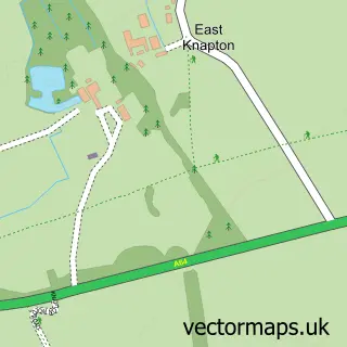
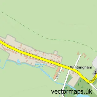
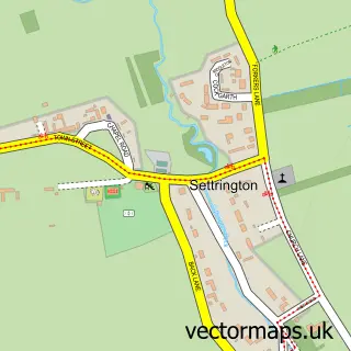
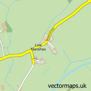
Nearby street map samples around Rillington

Street map sample of Norton-on-Derwent, North Yorkshire Norton-on-Derwent Town - North Yorkshire - 4.3 miles Street map sample of York, North Yorkshire York City - North Yorkshire - 20.9 miles Street map sample of Scampston, North Yorkshire Scampston Village - North Yorkshire - 0.8 miles Street map sample of Thorpe Bassett, North Yorkshire Thorpe Bassett Village - North Yorkshire - 0.9 miles Street map sample of Scagglethorpe, North Yorkshire Scagglethorpe Village - North Yorkshire - 1.6 miles Street map sample of Knapton, North Yorkshire Knapton Village - North Yorkshire - 1.9 miles Street map sample of Wintringham, North Yorkshire Wintringham Village - North Yorkshire - 1.9 miles Street map sample of Settrington, North Yorkshire Settrington Village - North Yorkshire - 2.6 miles Street map sample of Marishes, North Yorkshire Marishes Village - North Yorkshire - 2.8 miles Street map sample of Old Malton, North Yorkshire Old Malton Village - North Yorkshire - 3.5 miles

More street maps in North Yorkshire

Street map sample of Scampston, North Yorkshire Scampston Village - 0.8 miles Street map sample of Thorpe Bassett, North Yorkshire Thorpe Bassett Village - 0.9 miles Street map sample of Scagglethorpe, North Yorkshire Scagglethorpe Village - 1.6 miles Street map sample of Knapton, North Yorkshire Knapton Village - 1.9 miles Street map sample of Wintringham, North Yorkshire Wintringham Village - 1.9 miles

750 metre map area coverage

Boundary, postcode and point of interest information for the 750m x 750m rectangle centred on this sample map.

Boundaries containing map centre

Constituency: Thirsk and Malton Co Const

District: North Yorkshire

Icb: NHS Humber and North Yorkshire ICB

Parish: Rillington CP

Police Force: north yorkshire

Postcode District: YO17

Postcode Sector: YO17 8

Nearby boundaries intersecting sample

No additional intersecting boundaries found.

Postcode coverage

YO17 YO17 8

POI category counts

Appliance Store: 2

Automotive Repair: 2

Plastic Fabrication Company: 2

Pub: 2

Shipping Center: 2

Agricultural Service: 1

Anglican Church: 1

Automotive Services And Repair: 1

Beauty And Spa: 1

Bridal Shop: 1

Sample points of interest

  • M Jeffrey Agricultural Services Agricultural Service
  • St Andrew Anglican Church
  • Steve Aga Services Appliance Store
  • Steve Aga Services Appliance Store
  • MSJheadliners Automotive Repair
  • Specialist Dents Automotive Repair
  • Dempsey Precision Automotive Services And Repair
  • The Shearing Shed Beauty And Spa
  • Confetti Bridal Shop
  • Stuart Elvidge Joinery Services Building Supply Store
  • Kent Building Developments Ltd. Business Management Services
  • Turners Butchers Butcher Shop

Create a larger editable map of Rillington

This sample shows only a 750 metre area. To create a larger map of Rillington, use our map builder to choose your own coverage area, add titles and download editable SVG, PDF and PNG files.

Create a custom map of Rillington

Phone 01751 473136 | Copyright Vectormaps.uk 2026

Samples Customizer Privacy Disclaimer
Rillington Vector Street Map
Rillington enlarged street map sample showing a 750 metre preview area