Vector Maps logo
Home Why it works Popular maps Districts Samples Customizer Create Your Map
VectorMaps.uk
Home Popular maps Districts Samples Customizer Create Your Map Privacy Disclaimer
Home / UK Maps / North Yorkshire / York Map

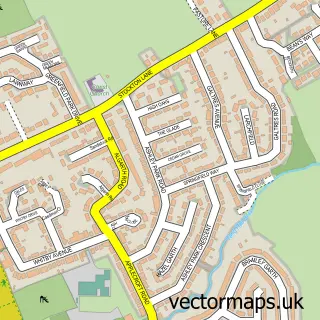
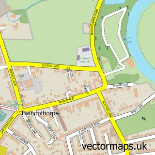
This York street map is a detailed vector street map covering a 750m x 750m area. Select a larger area to create and download your own vector street map of York.

York is a city in North Yorkshire, in the Yorkshire And The Humber of England. Historically, the area formed part of Yorkshire. The settlement falls within the York Outer parliamentary constituency. It is served by the YO10 postcode district, with YO10 4

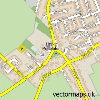
The 750-metre map sample for York covers 209 mapped buildings and approximately 23.2 km of road detail, of which 95 named roads are named. The immediate area includes 1 GP surgery, with 4 within 2 miles, 66 pubs and 18 MOT stations within 2 miles. The wider area around York features 63 tourism points of interest, 216 food and drink venues and 43 hotels. To create a larger or custom map of York, the map builder lets you define your own coverage area and download editable SVG, PDF and PNG files.

209Buildings
23.19 kmRoads
95Named roads
50,605Residents within 2 miles
Create your own

Create a larger editable map of York

Choose any area you need and generate a high-quality vector map instantly. Perfect for print, planning, design, business and personal use.

Choose any location
Editable SVG files
Any size up to A0
PDF, PNG & more
Instant download
High quality guaranteed
Create My Custom Map
Secure, private & no credit card required
York Vector Street Map
750m Sample
York vector street map sample showing roads, buildings and local features in a 750 metre preview area
Buy York Map Print from £12.95 Buy York Digital Map from £6

This York street map in North Yorkshire is available as downloadable SVG, PDF and PNG map files, or as a printed map for planning, business, display, education, local information and design work. You can also create a larger custom map area using the map selector.

What this York map sample shows

York lies within Fulford Cp parish, part of Fulford & Heslington ward in the York (B) local authority area. The postcode geography for this area includes the YO postcode area, the YO10 postcode district and the YO10 4 postcode sector. Residents fall under the Nhs Humber And North Yorkshire Integrated Care Board for NHS services.

Local features near York

Within 2 miles

Amenities and services in and around York.

2 Campsites within 2 miles
1 GP surgeries 4 within 2 miles
18 MOT stations within 2 miles
63 Tourism & leisure
216 Food & drink
66 Pubs
43 Hotels
28 Healthcare POIs
8 Vehicle services

Counts are approximate and based on publicly available data.

Administrative and postcode information for York

York lies within Fulford Cp parish, part of Fulford & Heslington ward in the York (B) local authority area. The postcode geography for this area includes the YO postcode area, the YO10 postcode district and the YO10 4 postcode sector. Residents fall under the Nhs Humber And North Yorkshire Integrated Care Board for NHS services.

Parish Fulford CP
Ward Fulford & Heslington
District / local authority York (B)
County North Yorkshire
Historic county Yorkshire
Postcode district YO10
Postcode sector YO10 4
Parliamentary constituency York Outer
Region Yorkshire and the Humber
Country England

Nearby street map samples around York

Street map sample of Haxby, North Yorkshire Haxby Town - North Yorkshire - 4.1 miles Street map sample of Heworth Without, North Yorkshire Heworth Without Village - North Yorkshire - 1.7 miles Street map sample of Heslington, North Yorkshire Heslington Village - North Yorkshire - 1.7 miles Street map sample of Osbaldwick, North Yorkshire Osbaldwick Village - North Yorkshire - 2.0 miles Street map sample of New Earswick, North Yorkshire New Earswick Village - North Yorkshire - 2.3 miles Street map sample of Bishopthorpe, North Yorkshire Bishopthorpe Village - North Yorkshire - 2.6 miles Street map sample of Huntington, North Yorkshire Huntington Village - North Yorkshire - 2.9 miles Street map sample of Murton, North Yorkshire Murton Village - North Yorkshire - 2.9 miles Street map sample of Nether Poppleton, North Yorkshire Nether Poppleton Village - North Yorkshire - 3.2 miles Street map sample of Upper Poppleton, North Yorkshire Upper Poppleton Village - North Yorkshire - 3.3 miles

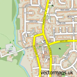
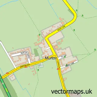
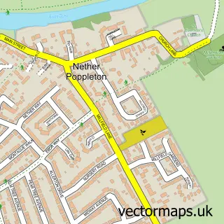
More street maps in North Yorkshire

Street map sample of Heworth Without, North Yorkshire Heworth Without Village - 1.7 miles Street map sample of Heslington, North Yorkshire Heslington Village - 1.7 miles Street map sample of Osbaldwick, North Yorkshire Osbaldwick Village - 2.0 miles Street map sample of New Earswick, North Yorkshire New Earswick Village - 2.3 miles Street map sample of Bishopthorpe, North Yorkshire Bishopthorpe Village - 2.6 miles

750 metre map area coverage

Boundary, postcode and point of interest information for the 750m x 750m rectangle centred on this sample map.

Boundaries containing map centre

Constituency: York Central Boro Const

District: York (B)

Icb: NHS Humber and North Yorkshire ICB

Police Force: north yorkshire

Postcode District: YO1

Postcode Sector: YO1 8

Ward: Guildhall Ward

Nearby boundaries intersecting sample

Postcode District: YO30, YO31

Postcode Sector: YO1 6, YO1 7, YO1 9, YO30 7, YO31 7

Ward: Micklegate Ward

Postcode coverage

YO1 YO1 8 YO30 YO31 YO1 6 YO1 7 YO1 9 YO30 7 YO31 7

POI category counts

Clothing Store: 76

Pub: 67

Cafe: 58

Restaurant: 51

Jewelry Store: 48

Bar: 45

Hotel: 42

Coffee Shop: 41

Professional Services: 38

Hair Salon: 34

Sample points of interest

  • Rathmell Hall Accommodation
  • The Old Gallery & Chamber Accommodation
  • 360 Chartered Accountants Accountant
  • Equilibrium Accountants Accountant
  • Franks Accountants Accountant
  • Hunter Gee Holroyd Accountants & Business Advisors Accountant
  • The Aesthetics Accountant Accountant
  • Uhy Calvert Smith Accountant
  • Tumble Tots York Active Life
  • Xscape Castleford Active Life
  • thepickleballshedyork Active Life
  • A D Siege Advertising Agency

Create a larger editable map of York

This sample shows only a 750 metre area. To create a larger map of York, use our map builder to choose your own coverage area, add titles and download editable SVG, PDF and PNG files.

Create a custom map of York

Phone 01751 473136 | Copyright Vectormaps.uk 2026

Samples Customizer Privacy Disclaimer
York Vector Street Map
York enlarged street map sample showing a 750 metre preview area