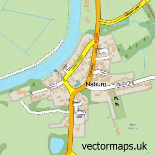
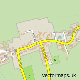
This Bishopthorpe street map is a detailed vector street map covering a 750m x 750m area. Select a larger area to create and download your own vector street map of Bishopthorpe.
The 750-metre map sample for Bishopthorpe covers 283 mapped buildings and approximately 11.6 km of road detail, of which 23 named roads are named. The immediate area includes 2 schools, 1 GP surgery within 2 miles, 3 pubs and 3 MOT stations within 2 miles. The wider area around Bishopthorpe features 3 tourism points of interest, 5 food and drink venues and 2 campsites within 2 miles. To create a larger or custom map of Bishopthorpe, the map builder lets you define your own coverage area and download editable SVG, PDF and PNG files.
Create a larger editable map of Bishopthorpe
Choose any area you need and generate a high-quality vector map instantly. Perfect for print, planning, design, business and personal use.

This Bishopthorpe street map in North Yorkshire is available as downloadable SVG, PDF and PNG map files, or as a printed map for planning, business, display, education, local information and design work. You can also create a larger custom map area using the map selector.
What this Bishopthorpe map sample shows
Bishopthorpe lies within Bishopthorpe Cp parish, part of Bishopthorpe ward in the York (B) local authority area. The postcode geography for this area includes the YO postcode area, the YO23 postcode district and the YO23 2 postcode sector. Residents fall under the Nhs Humber And North Yorkshire Integrated Care Board for NHS services.
Local features near Bishopthorpe
Within 2 milesAmenities and services in and around Bishopthorpe.
Administrative and postcode information for Bishopthorpe
Bishopthorpe lies within Bishopthorpe Cp parish, part of Bishopthorpe ward in the York (B) local authority area. The postcode geography for this area includes the YO postcode area, the YO23 postcode district and the YO23 2 postcode sector. Residents fall under the Nhs Humber And North Yorkshire Integrated Care Board for NHS services.
Nearby street map samples around Bishopthorpe


More street maps in North Yorkshire
750 metre map area coverage
Boundary, postcode and point of interest information for the 750m x 750m rectangle centred on this sample map.
Boundaries containing map centre
Constituency: York Outer Co Const
District: York (B)
Icb: NHS Humber and North Yorkshire ICB
Parish: Bishopthorpe CP
Police Force: north yorkshire
Postcode District: YO23
Postcode Sector: YO23 2
Ward: Bishopthorpe Ward
Nearby boundaries intersecting sample
Parish: Fulford CP
Postcode District: YO19
Postcode Sector: YO19 4
Ward: Fulford & Heslington Ward
Postcode coverage
POI category counts
Flowers And Gifts Shop: 3
Hair Salon: 3
Post Office: 3
Pub: 3
Bakery: 2
Church Cathedral: 2
Coffee Shop: 2
Electrician: 2
Elementary School: 2
Landmark And Historical Building: 2
Sample points of interest
- Little Green Rascals Children's Day Nursery & Out of School Club - Bishopthorpe
- St Andrew
- DUVET - the Ultimate Covers Band
- The Cooperative Food (BF) Bishopthorpe, Bishopthorpe
- Zak & Flo
- Fred's Home Bakery
- Valkyrie Cakes
- Four Gents Barber Shop
- The Beauty Barn
- Twisted Cogs
- Mitchell & Urwin Brickwork Contractors
- Riverside Caravan & Camping Park
Create a larger editable map of Bishopthorpe
This sample shows only a 750 metre area. To create a larger map of Bishopthorpe, use our map builder to choose your own coverage area, add titles and download editable SVG, PDF and PNG files.
Create a custom map of Bishopthorpe