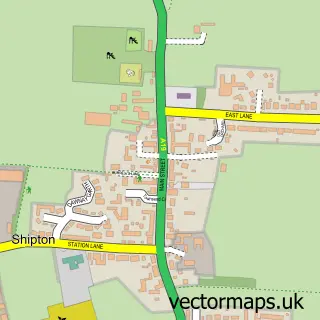
This Upper Poppleton street map is a detailed vector street map covering a 750m x 750m area. Select a larger area to create and download your own vector street map of Upper Poppleton.
The 750-metre map sample for Upper Poppleton covers 403 mapped buildings and approximately 15.0 km of road detail, of which 31 named roads are named. The immediate area includes 4 pubs and 9 MOT stations within 2 miles. The wider area around Upper Poppleton features 1 tourism point of interest, 5 food and drink venues and 2 campsites within 2 miles. To create a larger or custom map of Upper Poppleton, the map builder lets you define your own coverage area and download editable SVG, PDF and PNG files.
Create a larger editable map of Upper Poppleton
Choose any area you need and generate a high-quality vector map instantly. Perfect for print, planning, design, business and personal use.

This Upper Poppleton street map in North Yorkshire is available as downloadable SVG, PDF and PNG map files, or as a printed map for planning, business, display, education, local information and design work. You can also create a larger custom map area using the map selector.
What this Upper Poppleton map sample shows
Upper Poppleton lies within Upper Poppleton Cp parish, part of Rural West York ward in the York (B) local authority area. The postcode geography for this area includes the YO postcode area, the YO26 postcode district and the YO26 6 postcode sector. Residents fall under the Nhs Humber And North Yorkshire Integrated Care Board for NHS services.
Local features near Upper Poppleton
Within 2 milesAmenities and services in and around Upper Poppleton.
Administrative and postcode information for Upper Poppleton
Upper Poppleton lies within Upper Poppleton Cp parish, part of Rural West York ward in the York (B) local authority area. The postcode geography for this area includes the YO postcode area, the YO26 postcode district and the YO26 6 postcode sector. Residents fall under the Nhs Humber And North Yorkshire Integrated Care Board for NHS services.
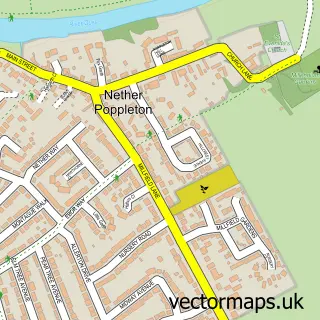
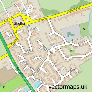
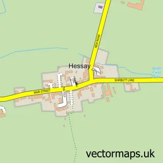
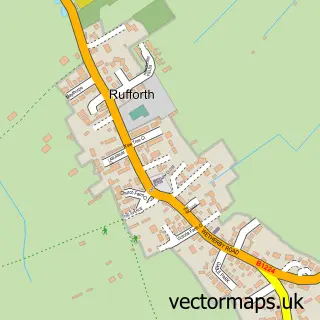
Nearby street map samples around Upper Poppleton


More street maps in North Yorkshire
750 metre map area coverage
Boundary, postcode and point of interest information for the 750m x 750m rectangle centred on this sample map.
Boundaries containing map centre
Constituency: York Outer Co Const
District: York (B)
Icb: NHS Humber and North Yorkshire ICB
Parish: Upper Poppleton CP
Police Force: north yorkshire
Postcode District: YO26
Postcode Sector: YO26 6
Ward: Rural West York Ward
Nearby boundaries intersecting sample
No additional intersecting boundaries found.
Postcode coverage
POI category counts
Pub: 4
Beauty Salon: 2
Doctor: 2
Grocery Store: 2
Anglican Church: 1
Arts And Entertainment: 1
Assisted Living Facility: 1
Automotive: 1
Bed And Breakfast: 1
Church Cathedral: 1
Sample points of interest
- All Saints'
- Tom Thumb Designs
- Roseville Care Homes
- Tockwith Multidrive Training Centre
- Peter Hart Hair Clinic
- Sculpt aesthetics and semi permanent make up
- Grove House Bed and Breakfast
- Poppleton Methodist Church
- Poppleton coffee on the green
- Leeper and Deighton
- Nisa Local
- M Bayne
Create a larger editable map of Upper Poppleton
This sample shows only a 750 metre area. To create a larger map of Upper Poppleton, use our map builder to choose your own coverage area, add titles and download editable SVG, PDF and PNG files.
Create a custom map of Upper Poppleton