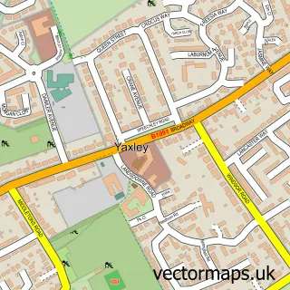
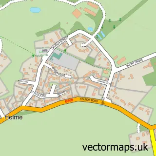
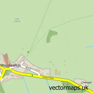
This Sawtry street map is a detailed vector street map covering a 750m x 750m area. Select a larger area to create and download your own vector street map of Sawtry.
The 750-metre map sample for Sawtry covers 623 mapped buildings and approximately 15.8 km of road detail, of which 39 named roads are named. The immediate area includes 2 primary schools and 1 secondary school, 1 GP surgery, 2 pubs and 1 MOT station, with 2 within 2 miles. The wider area around Sawtry features 2 food and drink venues. To create a larger or custom map of Sawtry, the map builder lets you define your own coverage area and download editable SVG, PDF and PNG files.
Create a larger editable map of Sawtry
Choose any area you need and generate a high-quality vector map instantly. Perfect for print, planning, design, business and personal use.

This Sawtry street map in Cambridgeshire is available as downloadable SVG, PDF and PNG map files, or as a printed map for planning, business, display, education, local information and design work. You can also create a larger custom map area using the map selector.
What this Sawtry map sample shows
Sawtry lies within Sawtry Cp parish, part of Sawtry ward in the Huntingdonshire District local authority area. The postcode geography for this area includes the PE postcode area, the PE28 postcode district and the PE28 5 postcode sector. Residents fall under the Nhs Cambridgeshire And Peterborough Integrated Care Board for NHS services.
Local features near Sawtry
Within 2 milesAmenities and services in and around Sawtry.
Administrative and postcode information for Sawtry
The local authority covering Sawtry is Huntingdonshire District, within the county of Cambridgeshire. The settlement lies within Sawtry ward and Sawtry Cp civil parish. The PE28 postcode district and PE28 5 postcode sector serve the immediate area. NHS provision in the area is delivered through North West Anglia Nhs Foundation Trust.
Nearby street map samples around Sawtry

More street maps in Cambridgeshire
750 metre map area coverage
Boundary, postcode and point of interest information for the 750m x 750m rectangle centred on this sample map.
Boundaries containing map centre
Constituency: Huntingdon Co Const
County: Cambridgeshire County
District: Huntingdonshire District
Icb: NHS Central East ICB
Parish: Sawtry CP
Police Force: cambridgeshire
Postcode District: PE28
Postcode Sector: PE28 5
Ward: Sawtry Ward
Nearby boundaries intersecting sample
No additional intersecting boundaries found.
Postcode coverage
POI category counts
Elementary School: 4
Gym: 4
Professional Services: 4
Anglican Church: 2
Beauty Salon: 2
Building Supply Store: 2
Church Cathedral: 2
Community Services Non Profits: 2
Convenience Store: 2
Financial Service: 2
Sample points of interest
- Academy Leisure Sawtry
- Garry Hares Clinic
- All Saints Church
- Sawtry; All Saints
- Village Glass & Glazing
- Gema Supplies & Services
- Anglia Wedding D J
- Beautiful Salon Sawtry
- Sawtry Beauty Clinic
- Fresco Clean
- Marshall Window Cleaning
- The Butchers Blade
Create a larger editable map of Sawtry
This sample shows only a 750 metre area. To create a larger map of Sawtry, use our map builder to choose your own coverage area, add titles and download editable SVG, PDF and PNG files.
Create a custom map of Sawtry