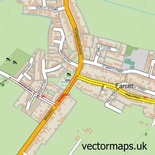
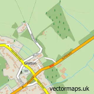
This Yaxley street map is a detailed vector street map covering a 750m x 750m area. Select a larger area to create and download your own vector street map of Yaxley.
The 750-metre map sample for Yaxley covers 552 mapped buildings and approximately 17.5 km of road detail, of which 34 named roads are named. The immediate area includes 1 school, 1 GP surgery, with 2 within 2 miles and 11 MOT stations within 2 miles. The wider area around Yaxley features 2 tourism points of interest and 6 food and drink venues. To create a larger or custom map of Yaxley, the map builder lets you define your own coverage area and download editable SVG, PDF and PNG files.
Create a larger editable map of Yaxley
Choose any area you need and generate a high-quality vector map instantly. Perfect for print, planning, design, business and personal use.

This Yaxley street map in Cambridgeshire is available as downloadable SVG, PDF and PNG map files, or as a printed map for planning, business, display, education, local information and design work. You can also create a larger custom map area using the map selector.
What this Yaxley map sample shows
Yaxley lies within Yaxley Cp parish, part of Yaxley ward in the Huntingdonshire District local authority area. The postcode geography for this area includes the PE postcode area, the PE7 postcode district and the PE7 3 postcode sector. Residents fall under the Nhs Cambridgeshire And Peterborough Integrated Care Board for NHS services.
Local features near Yaxley
Within 2 milesAmenities and services in and around Yaxley.
Administrative and postcode information for Yaxley
The local authority covering Yaxley is Huntingdonshire District, within the county of Cambridgeshire. The settlement lies within Yaxley ward and Yaxley Cp civil parish. The PE7 postcode district and PE7 3 postcode sector serve the immediate area. NHS provision in the area is delivered through North West Anglia Nhs Foundation Trust.
Nearby street map samples around Yaxley

More street maps in Cambridgeshire
750 metre map area coverage
Boundary, postcode and point of interest information for the 750m x 750m rectangle centred on this sample map.
Boundaries containing map centre
Constituency: North West Cambridgeshire Co Const
County: Cambridgeshire County
District: Huntingdonshire District
Icb: NHS Central East ICB
Parish: Yaxley CP
Police Force: cambridgeshire
Postcode District: PE7
Postcode Sector: PE7 3
Ward: Yaxley Ward
Nearby boundaries intersecting sample
District: City of Peterborough (B)
Ward: Hargate & Hempsted Ward
Postcode coverage
POI category counts
Charity Organization: 4
Convenience Store: 4
Beauty Salon: 3
Contractor: 3
Flowers And Gifts Shop: 3
Pet Store: 3
Pizza Restaurant: 3
Post Office: 3
Professional Services: 3
Building Supply Store: 2
Sample points of interest
- BR Spar Yaxley (Swap), Yaxley
- Queens Park Football Ground
- Mirror Shine Motors
- Head 2 Head Barbers
- Jennifer Rose - lash design & training academy
- Arabellaz
- Beauty Rituals Advanced skin and Aesthetics
- Hair at sophisti-cut
- 1st Choice Skip Hire
- Mini Digger Hire (Peterborough)
- WoffleOn
- sunny cafe
Create a larger editable map of Yaxley
This sample shows only a 750 metre area. To create a larger map of Yaxley, use our map builder to choose your own coverage area, add titles and download editable SVG, PDF and PNG files.
Create a custom map of Yaxley