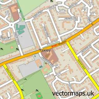
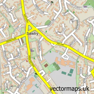
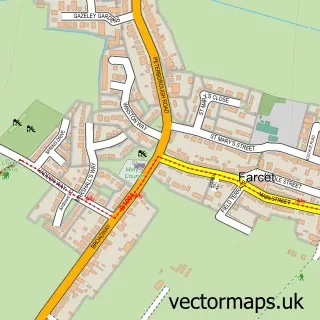
This Stilton street map is a detailed vector street map covering a 750m x 750m area. Select a larger area to create and download your own vector street map of Stilton.
The 750-metre map sample for Stilton covers 349 mapped buildings and approximately 20.6 km of road detail, of which 23 named roads are named. The immediate area includes 3 pubs and 2 MOT stations within 2 miles. The wider area around Stilton features 6 food and drink venues and 1 hotel. To create a larger or custom map of Stilton, the map builder lets you define your own coverage area and download editable SVG, PDF and PNG files.
Create a larger editable map of Stilton
Choose any area you need and generate a high-quality vector map instantly. Perfect for print, planning, design, business and personal use.

This Stilton street map in Cambridgeshire is available as downloadable SVG, PDF and PNG map files, or as a printed map for planning, business, display, education, local information and design work. You can also create a larger custom map area using the map selector.
What this Stilton map sample shows
Stilton lies within Stilton Cp parish, part of Stilton, Folksworth & Washingley ward in the Huntingdonshire District local authority area. The postcode geography for this area includes the PE postcode area, the PE7 postcode district and the PE7 3 postcode sector. Residents fall under the Nhs Cambridgeshire And Peterborough Integrated Care Board for NHS services.
Local features near Stilton
Within 2 milesAmenities and services in and around Stilton.
Administrative and postcode information for Stilton
Stilton lies within Stilton Cp parish, part of Stilton, Folksworth & Washingley ward in the Huntingdonshire District local authority area. The postcode geography for this area includes the PE postcode area, the PE7 postcode district and the PE7 3 postcode sector. Residents fall under the Nhs Cambridgeshire And Peterborough Integrated Care Board for NHS services.
Nearby street map samples around Stilton

More street maps in Cambridgeshire
750 metre map area coverage
Boundary, postcode and point of interest information for the 750m x 750m rectangle centred on this sample map.
Boundaries containing map centre
Constituency: North West Cambridgeshire Co Const
County: Cambridgeshire County
District: Huntingdonshire District
Icb: NHS Central East ICB
Parish: Stilton CP
Police Force: cambridgeshire
Postcode District: PE7
Postcode Sector: PE7 3
Ward: Stilton, Folksworth & Washingley Ward
Nearby boundaries intersecting sample
No additional intersecting boundaries found.
Postcode coverage
POI category counts
Pub: 3
Rental Kiosks: 3
Bar: 2
Convenience Store: 2
Indian Restaurant: 2
Nail Salon: 2
Shipping Center: 2
Advertising Agency: 1
Appliance Manufacturer: 1
Architectural Designer: 1
Sample points of interest
- Stilton Surveys
- Gordon Rehab
- David Hartley Associates
- Oak House
- Cakes by Carol
- The S Bar
- The S Bar Stilton
- Indybeautyuk
- Ten Hairdressing Stilton
- The Stilton Cheese Inn
- B M Pest Solutions
- Ali's Coffee Box
Create a larger editable map of Stilton
This sample shows only a 750 metre area. To create a larger map of Stilton, use our map builder to choose your own coverage area, add titles and download editable SVG, PDF and PNG files.
Create a custom map of Stilton