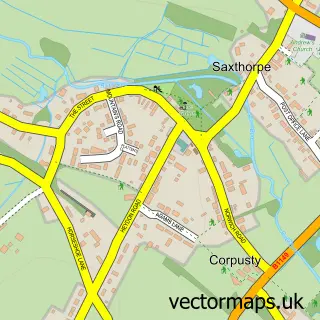
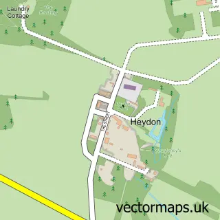
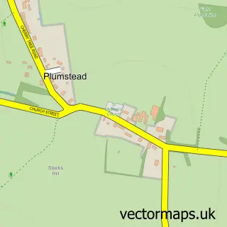
This Saxthorpe street map is a detailed vector street map covering a 750m x 750m area. Select a larger area to create and download your own vector street map of Saxthorpe.
The 750-metre map sample for Saxthorpe covers 160 mapped buildings and approximately 14.5 km of road detail, of which 8 named roads are named. The immediate area includes 1 school and 1 pub. The wider area around Saxthorpe features 1 tourism point of interest and 2 food and drink venues. To create a larger or custom map of Saxthorpe, the map builder lets you define your own coverage area and download editable SVG, PDF and PNG files.
Create a larger editable map of Saxthorpe
Choose any area you need and generate a high-quality vector map instantly. Perfect for print, planning, design, business and personal use.

This Saxthorpe street map in Norfolk is available as downloadable SVG, PDF and PNG map files, or as a printed map for planning, business, display, education, local information and design work. You can also create a larger custom map area using the map selector.
What this Saxthorpe map sample shows
Saxthorpe lies within Corpusty And Saxthorpe Cp parish, part of Stody ward in the North Norfolk District local authority area. The postcode geography for this area includes the NR postcode area, the NR11 postcode district and the NR11 7 postcode sector. Residents fall under the Nhs Norfolk And Waveney Integrated Care Board for NHS services.
Local features near Saxthorpe
Within 2 milesAmenities and services in and around Saxthorpe.
Administrative and postcode information for Saxthorpe
The local authority covering Saxthorpe is North Norfolk District, within the county of Norfolk. The settlement lies within Stody ward and Corpusty And Saxthorpe Cp civil parish. The NR11 postcode district and NR11 7 postcode sector serve the immediate area. NHS provision in the area is delivered through Norfolk And Norwich University Hospitals Nhs Foundation Trust.
Nearby street map samples around Saxthorpe

More street maps in Norfolk
750 metre map area coverage
Boundary, postcode and point of interest information for the 750m x 750m rectangle centred on this sample map.
Boundaries containing map centre
Constituency: North Norfolk Co Const
County: Norfolk County
District: North Norfolk District
Icb: NHS Norfolk and Waveney ICB
Parish: Corpusty and Saxthorpe CP
Police Force: norfolk
Postcode District: NR11
Postcode Sector: NR11 7
Ward: Stody Ward
Nearby boundaries intersecting sample
Postcode Sector: NR11 6
Postcode coverage
POI category counts
Convenience Store: 2
Farm: 2
Post Office: 2
Anglican Church: 1
Art Gallery: 1
Auto Company: 1
Bakery: 1
Coffee Shop: 1
Elementary School: 1
Food Beverage Service Distribution: 1
Sample points of interest
- Saxthorpe with Corpusty: St Andrew
- The Old Workshop Gallery
- DubMotion Campers Ltd
- Victoria Jane Bakes
- Corpusty & Saxthorpe Station Cafe
- SPAR
- SPAR - Harvest Energy Roughton
- Corpusty Primary School
- Church Farm
- Saxthorpe
- Westend Banqueting Hire
- Corbett Woodwork
Create a larger editable map of Saxthorpe
This sample shows only a 750 metre area. To create a larger map of Saxthorpe, use our map builder to choose your own coverage area, add titles and download editable SVG, PDF and PNG files.
Create a custom map of Saxthorpe