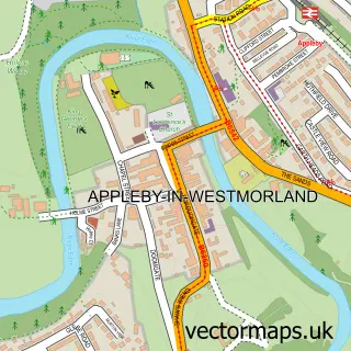
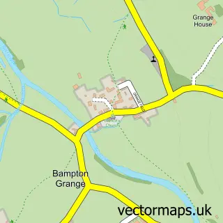
This Shap street map is a detailed vector street map covering a 750m x 750m area. Select a larger area to create and download your own vector street map of Shap.
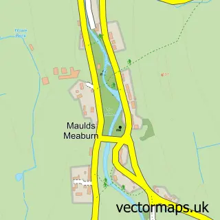
The 750-metre map sample for Shap covers 212 mapped buildings and approximately 9.5 km of road detail, of which 20 named roads are named. The immediate area includes 1 school, 1 GP surgery, 1 pub and 1 MOT station. The wider area around Shap features 2 tourism points of interest, 3 food and drink venues and 1 hotel. To create a larger or custom map of Shap, the map builder lets you define your own coverage area and download editable SVG, PDF and PNG files.
Create a larger editable map of Shap
Choose any area you need and generate a high-quality vector map instantly. Perfect for print, planning, design, business and personal use.

This Shap street map in Cumbria is available as downloadable SVG, PDF and PNG map files, or as a printed map for planning, business, display, education, local information and design work. You can also create a larger custom map area using the map selector.
What this Shap map sample shows
Shap lies within Shap Cp parish, part of Shap ward in the Westmorland And Furness local authority area. The postcode geography for this area includes the CA postcode area, the CA10 postcode district and the CA10 3 postcode sector. Residents fall under the Nhs North East And North Cumbria Integrated Care Board for NHS services.
Local features near Shap
Within 2 milesAmenities and services in and around Shap.
Administrative and postcode information for Shap
The local authority covering Shap is Westmorland And Furness, within the county of Cumbria. The settlement lies within Shap ward and Shap Cp civil parish. The CA10 postcode district and CA10 3 postcode sector serve the immediate area. NHS provision in the area is delivered through North Cumbria Integrated Care Nhs Foundation Trust.
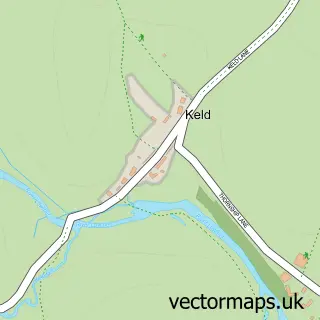
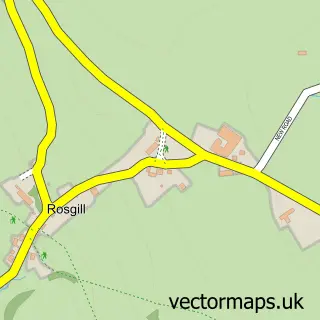
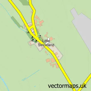
Nearby street map samples around Shap

More street maps in Cumbria
750 metre map area coverage
Boundary, postcode and point of interest information for the 750m x 750m rectangle centred on this sample map.
Boundaries containing map centre
Constituency: Westmorland and Lonsdale Co Const
District: Westmorland and Furness
Icb: NHS North East and North Cumbria ICB
Parish: Shap CP
Police Force: cumbria
Postcode District: CA10
Postcode Sector: CA10 3
Ward: Eamont and Shap Ward
Nearby boundaries intersecting sample
No additional intersecting boundaries found.
Postcode coverage
POI category counts
Automotive Repair: 2
Business Management Services: 2
Cafe: 2
Community Center: 2
Adult Education: 1
Ambulance And Ems Services: 1
Anglican Church: 1
Bank Credit Union: 1
Banks: 1
Charity Organization: 1
Sample points of interest
- Shap Cdc
- CERT - Community Emergency Response Team - UK
- St Michael's, Shap
- R Iveson Main Street Garage
- Rob Iveson Mechanic
- NatWest
- NatWest Mobile Branch
- Bea Ray Garden Design Ltd.
- Shap Post Office
- Marsel's Shap
- Marsel's Shap
- Age UK
Create a larger editable map of Shap
This sample shows only a 750 metre area. To create a larger map of Shap, use our map builder to choose your own coverage area, add titles and download editable SVG, PDF and PNG files.
Create a custom map of Shap