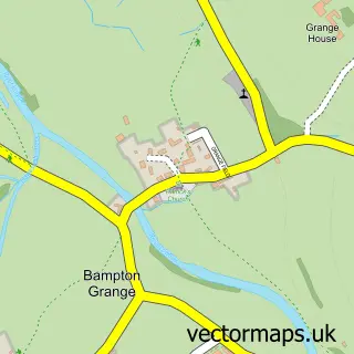
This Bampton street map is a detailed vector street map covering a 750m x 750m area. Select a larger area to create and download your own vector street map of Bampton.
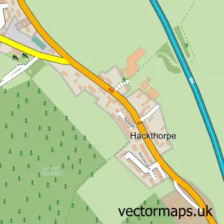
The 750-metre map sample for Bampton covers 37 mapped buildings and approximately 5.7 km of road detail. The immediate area includes 1 pub. The wider area around Bampton features 1 tourism point of interest and 1 food and drink venue. To create a larger or custom map of Bampton, the map builder lets you define your own coverage area and download editable SVG, PDF and PNG files.
Create a larger editable map of Bampton
Choose any area you need and generate a high-quality vector map instantly. Perfect for print, planning, design, business and personal use.

This Bampton street map in Cumbria is available as downloadable SVG, PDF and PNG map files, or as a printed map for planning, business, display, education, local information and design work. You can also create a larger custom map area using the map selector.
What this Bampton map sample shows
Bampton lies within Bampton Cp parish, part of Askham ward in the Westmorland And Furness local authority area. The postcode geography for this area includes the CA postcode area, the CA10 postcode district and the CA10 2 postcode sector. Residents fall under the Nhs North East And North Cumbria Integrated Care Board for NHS services.
Local features near Bampton
Within 2 milesAmenities and services in and around Bampton.
Administrative and postcode information for Bampton
Bampton lies within Bampton Cp parish, part of Askham ward in the Westmorland And Furness local authority area. The postcode geography for this area includes the CA postcode area, the CA10 postcode district and the CA10 2 postcode sector. Residents fall under the Nhs North East And North Cumbria Integrated Care Board for NHS services.
Nearby street map samples around Bampton

More street maps in Cumbria
750 metre map area coverage
Boundary, postcode and point of interest information for the 750m x 750m rectangle centred on this sample map.
Boundaries containing map centre
Constituency: Westmorland and Lonsdale Co Const
District: Westmorland and Furness
Icb: NHS North East and North Cumbria ICB
Parish: Bampton CP
Police Force: cumbria
Postcode District: CA10
Postcode Sector: CA10 2
Ward: Eamont and Shap Ward
Nearby boundaries intersecting sample
No additional intersecting boundaries found.
Postcode coverage
POI category counts
Bed And Breakfast: 1
Beer Bar: 1
Beverage Store: 1
Holiday Rental Home: 1
Lake: 1
Landmark And Historical Building: 1
Pub: 1
Shipping Center: 1
Travel: 1
Sample points of interest
- Bampton Village Store
- Mardale Inn
- The Mardale @ Bampton
- Mews Cottage
- Bampton, Lake District
- Haweswater Beck
- The Mardale Inn - Bampton Valley Community Pub
- Post Office-Bampton
- St Patrick's Well
Create a larger editable map of Bampton
This sample shows only a 750 metre area. To create a larger map of Bampton, use our map builder to choose your own coverage area, add titles and download editable SVG, PDF and PNG files.
Create a custom map of Bampton