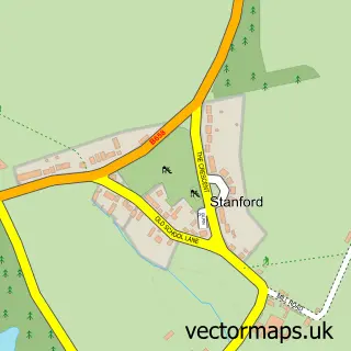
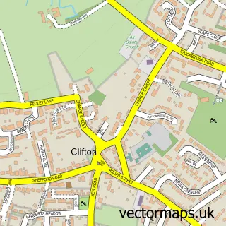
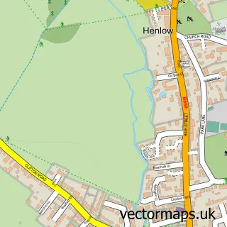
This Southill street map is a detailed vector street map covering a 750m x 750m area. Select a larger area to create and download your own vector street map of Southill.
The 750-metre map sample for Southill covers 79 mapped buildings and approximately 3.8 km of road detail, of which 1 named road are named. The immediate area includes 1 school. The wider area around Southill features 1 tourism point of interest. To create a larger or custom map of Southill, the map builder lets you define your own coverage area and download editable SVG, PDF and PNG files.
Create a larger editable map of Southill
Choose any area you need and generate a high-quality vector map instantly. Perfect for print, planning, design, business and personal use.

This Southill street map in Bedfordshire is available as downloadable SVG, PDF and PNG map files, or as a printed map for planning, business, display, education, local information and design work. You can also create a larger custom map area using the map selector.
What this Southill map sample shows
Southill lies within Southill Cp parish, part of Northill ward in the Central Bedfordshire local authority area. The postcode geography for this area includes the SG postcode area, the SG18 postcode district and the SG18 9 postcode sector. Residents fall under the Nhs Bedfordshire, Luton And Milton Keynes Integrated Care Board for NHS services.
Local features near Southill
Within 2 milesAmenities and services in and around Southill.
Administrative and postcode information for Southill
Southill lies within Southill Cp parish, part of Northill ward in the Central Bedfordshire local authority area. The postcode geography for this area includes the SG postcode area, the SG18 postcode district and the SG18 9 postcode sector. Residents fall under the Nhs Bedfordshire, Luton And Milton Keynes Integrated Care Board for NHS services.
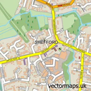
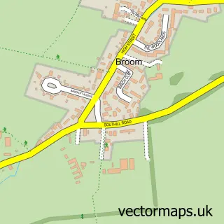
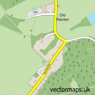
Nearby street map samples around Southill

More street maps in Bedfordshire
750 metre map area coverage
Boundary, postcode and point of interest information for the 750m x 750m rectangle centred on this sample map.
Boundaries containing map centre
Constituency: North Bedfordshire Co Const
District: Central Bedfordshire
Icb: NHS Central East ICB
Parish: Southill CP
Police Force: bedfordshire
Postcode District: SG18
Postcode Sector: SG18 9
Ward: Northill Ward
Nearby boundaries intersecting sample
No additional intersecting boundaries found.
Postcode coverage
POI category counts
Business Manufacturing And Supply: 1
Dance School: 1
Elementary School: 1
Fruits And Vegetables: 1
Home Cleaning: 1
Metals: 1
Pet Services: 1
Roofing: 1
Tea Room: 1
Tours: 1
Sample points of interest
- Driftwood Joinery
- Stagecoach Performing Arts Biggleswade
- Southill Lower School
- Seasons Fruit & Veg
- IKG Cleaning Services
- Safe & Secure Systems Ltd.
- Purrsonal Touch Cat Accessories
- Shire Roofing
- Southill Tea Rooms and Village Stores
- Bedford–Hitchin line
Create a larger editable map of Southill
This sample shows only a 750 metre area. To create a larger map of Southill, use our map builder to choose your own coverage area, add titles and download editable SVG, PDF and PNG files.
Create a custom map of Southill