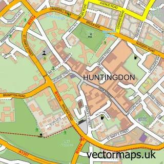
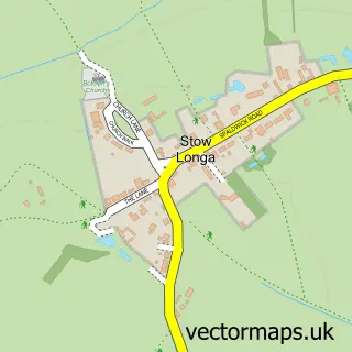
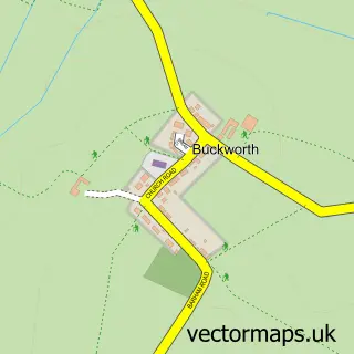
This Spaldwick street map is a detailed vector street map covering a 750m x 750m area. Select a larger area to create and download your own vector street map of Spaldwick.
The 750-metre map sample for Spaldwick covers 226 mapped buildings and approximately 12.5 km of road detail, of which 16 named roads are named. The immediate area includes 1 pub. The wider area around Spaldwick features 1 food and drink venue. To create a larger or custom map of Spaldwick, the map builder lets you define your own coverage area and download editable SVG, PDF and PNG files.
Create a larger editable map of Spaldwick
Choose any area you need and generate a high-quality vector map instantly. Perfect for print, planning, design, business and personal use.

This Spaldwick street map in Cambridgeshire is available as downloadable SVG, PDF and PNG map files, or as a printed map for planning, business, display, education, local information and design work. You can also create a larger custom map area using the map selector.
What this Spaldwick map sample shows
Spaldwick lies within Spaldwick Cp parish, part of Alconbury ward in the Huntingdonshire District local authority area. The postcode geography for this area includes the PE postcode area, the PE28 postcode district and the PE28 0 postcode sector. Residents fall under the Nhs Cambridgeshire And Peterborough Integrated Care Board for NHS services.
Local features near Spaldwick
Within 2 milesAmenities and services in and around Spaldwick.
Administrative and postcode information for Spaldwick
The local authority covering Spaldwick is Huntingdonshire District, within the county of Cambridgeshire. The settlement lies within Alconbury ward and Spaldwick Cp civil parish. The PE28 postcode district and PE28 0 postcode sector serve the immediate area. NHS provision in the area is delivered through North West Anglia Nhs Foundation Trust.
Nearby street map samples around Spaldwick

More street maps in Cambridgeshire
750 metre map area coverage
Boundary, postcode and point of interest information for the 750m x 750m rectangle centred on this sample map.
Boundaries containing map centre
Constituency: Huntingdon Co Const
County: Cambridgeshire County
District: Huntingdonshire District
Icb: NHS Central East ICB
Parish: Spaldwick CP
Police Force: cambridgeshire
Postcode District: PE28
Postcode Sector: PE28 0
Ward: Alconbury Ward
Nearby boundaries intersecting sample
No additional intersecting boundaries found.
Postcode coverage
POI category counts
Building Supply Store: 2
Anglican Church: 1
Beverage Supplier: 1
Business To Business Services: 1
Church Cathedral: 1
Community Center: 1
Convenience Store: 1
Courier And Delivery Services: 1
Electrician: 1
Elementary School: 1
Sample points of interest
- St James
- Waitrose & Partners
- Landscape Evolution
- Spaldwick Electrical
- ERAS
- St James's Church
- Cornerstone Christian Centre Doncaster
- Londis
- Evri ParcelShop
- Selec Group (Selec Solar, Spaldwick Electrical, Air Conditioning, Renewables)
- Spaldwick Community Primary School
- Jarrodean Healthcare Recruitment
Create a larger editable map of Spaldwick
This sample shows only a 750 metre area. To create a larger map of Spaldwick, use our map builder to choose your own coverage area, add titles and download editable SVG, PDF and PNG files.
Create a custom map of Spaldwick