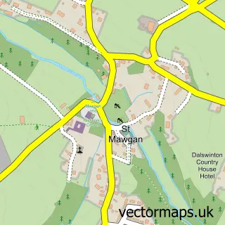
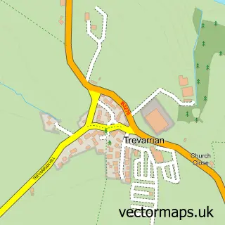
This St Eval street map is a detailed vector street map covering a 750m x 750m area. Select a larger area to create and download your own vector street map of St Eval.
The 750-metre map sample for St Eval covers 195 mapped buildings and approximately 8.8 km of road detail, of which 18 named roads are named. The immediate area includes 1 school and 1 MOT station within 2 miles. The wider area around St Eval features 3 campsites within 2 miles. To create a larger or custom map of St Eval, the map builder lets you define your own coverage area and download editable SVG, PDF and PNG files.
Create a larger editable map of St Eval
Choose any area you need and generate a high-quality vector map instantly. Perfect for print, planning, design, business and personal use.

This St Eval street map in Cornwall is available as downloadable SVG, PDF and PNG map files, or as a printed map for planning, business, display, education, local information and design work. You can also create a larger custom map area using the map selector.
What this St Eval map sample shows
St Eval lies within St. Eval Cp parish, part of St Issey And St Tudy ward in the Cornwall local authority area. The postcode geography for this area includes the PL postcode area, the PL27 postcode district and the PL27 7 postcode sector. Residents fall under the Nhs Cornwall And The Isles Of Scilly Integrated Care Board for NHS services.
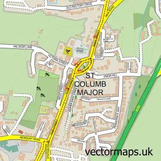
Local features near St Eval
Within 2 milesAmenities and services in and around St Eval.
Administrative and postcode information for St Eval
The local authority covering St Eval is Cornwall, within the county of Cornwall. The settlement lies within St Issey And St Tudy ward and St. Eval Cp civil parish. The PL27 postcode district and PL27 7 postcode sector serve the immediate area. NHS provision in the area is delivered through Royal Cornwall Hospitals Nhs Trust.
Nearby street map samples around St Eval

More street maps in Cornwall
750 metre map area coverage
Boundary, postcode and point of interest information for the 750m x 750m rectangle centred on this sample map.
Boundaries containing map centre
Constituency: North Cornwall Co Const
District: Cornwall
Icb: NHS Cornwall and the Isles of Scilly ICB
Parish: St. Eval CP
Police Force: devon and cornwall
Postcode District: PL27
Postcode Sector: PL27 7
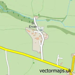
Nearby boundaries intersecting sample
Parish: St. Ervan CP
Postcode coverage
POI category counts
Building Supply Store: 3
Elementary School: 2
Korean Grocery Store: 2
Bakery: 1
Chocolatier: 1
Community Services Non Profits: 1
Convenience Store: 1
Currency Exchange: 1
Electrician: 1
Graphic Designer: 1
Sample points of interest
- Beach Street Bakery
- D&C Garden and Ground Maintenance
- Dalton Truscott Carpentry & Joinery
- Zuluelectrical
- Kernow Chocolate
- Community shop
- St eval stores ltd
- Post Office Travel Money
- Zulu Electrical
- Trevisker Community Primary School
- Trevisker Primary School
- Adam Smith Graphic Design
Create a larger editable map of St Eval
This sample shows only a 750 metre area. To create a larger map of St Eval, use our map builder to choose your own coverage area, add titles and download editable SVG, PDF and PNG files.
Create a custom map of St Eval