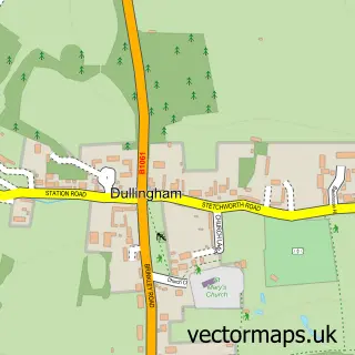
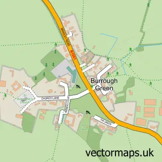
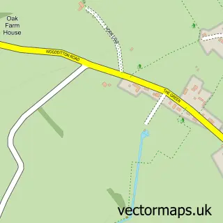
This Stetchworth street map is a detailed vector street map covering a 750m x 750m area. Select a larger area to create and download your own vector street map of Stetchworth.
The 750-metre map sample for Stetchworth covers 202 mapped buildings and approximately 6.3 km of road detail, of which 10 named roads are named. The immediate area includes 1 school and 1 pub. The wider area around Stetchworth features 1 food and drink venue and 2 hotels. To create a larger or custom map of Stetchworth, the map builder lets you define your own coverage area and download editable SVG, PDF and PNG files.
Create a larger editable map of Stetchworth
Choose any area you need and generate a high-quality vector map instantly. Perfect for print, planning, design, business and personal use.

This Stetchworth street map in Cambridgeshire is available as downloadable SVG, PDF and PNG map files, or as a printed map for planning, business, display, education, local information and design work. You can also create a larger custom map area using the map selector.
What this Stetchworth map sample shows
Stetchworth lies within Stetchworth Cp parish, part of Woodditton ward in the East Cambridgeshire District local authority area. The postcode geography for this area includes the CB postcode area, the CB8 postcode district and the CB8 9 postcode sector. Residents fall under the Nhs Cambridgeshire And Peterborough Integrated Care Board for NHS services.
Local features near Stetchworth
Within 2 milesAmenities and services in and around Stetchworth.
Administrative and postcode information for Stetchworth
The local authority covering Stetchworth is East Cambridgeshire District, within the county of Cambridgeshire. The settlement lies within Woodditton ward and Stetchworth Cp civil parish. The CB8 postcode district and CB8 9 postcode sector serve the immediate area. NHS provision in the area is delivered through West Suffolk Nhs Foundation Trust.
Nearby street map samples around Stetchworth

More street maps in Cambridgeshire
750 metre map area coverage
Boundary, postcode and point of interest information for the 750m x 750m rectangle centred on this sample map.
Boundaries containing map centre
Constituency: Ely and East Cambridgeshire Co Const
County: Cambridgeshire County
District: East Cambridgeshire District
Icb: NHS Central East ICB
Parish: Stetchworth CP
Police Force: cambridgeshire
Postcode District: CB8
Postcode Sector: CB8 9
Ward: Woodditton Ward
Nearby boundaries intersecting sample
Parish: Dullingham CP
Postcode coverage
POI category counts
Post Office: 4
Elementary School: 2
Youth Organizations: 2
Arts And Entertainment: 1
Banks: 1
Beauty Salon: 1
Business Consulting: 1
Child Care And Day Care: 1
Chiropractor: 1
Day Care Preschool: 1
Sample points of interest
- Stetchworth
- Barclays
- Scrumptious Beauty
- Teevan Consulting Network
- Eduvivre Group
- Julia Smith-Pearse
- The Old School House Nursery
- Kettlefields Primary School
- Kettlefields Primary School
- Vision Resources
- The Old Mill
- Betfred
Create a larger editable map of Stetchworth
This sample shows only a 750 metre area. To create a larger map of Stetchworth, use our map builder to choose your own coverage area, add titles and download editable SVG, PDF and PNG files.
Create a custom map of Stetchworth