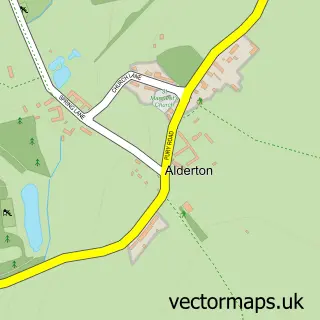
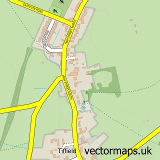
This Stoke Bruerne street map is a detailed vector street map covering a 750m x 750m area. Select a larger area to create and download your own vector street map of Stoke Bruerne.
The 750-metre map sample for Stoke Bruerne covers 139 mapped buildings and approximately 13.5 km of road detail, of which 7 named roads are named. The immediate area includes 1 school, 1 GP surgery within 2 miles, 4 pubs and 1 MOT station within 2 miles. The wider area around Stoke Bruerne features 6 tourism points of interest and 7 food and drink venues. To create a larger or custom map of Stoke Bruerne, the map builder lets you define your own coverage area and download editable SVG, PDF and PNG files.
Create a larger editable map of Stoke Bruerne
Choose any area you need and generate a high-quality vector map instantly. Perfect for print, planning, design, business and personal use.

This Stoke Bruerne street map in Northamptonshire is available as downloadable SVG, PDF and PNG map files, or as a printed map for planning, business, display, education, local information and design work. You can also create a larger custom map area using the map selector.
What this Stoke Bruerne map sample shows
Stoke Bruerne lies within Stoke Bruerne Cp parish, part of Tove ward in the West Northamptonshire local authority area. The postcode geography for this area includes the NN postcode area, the NN12 postcode district and the NN12 7 postcode sector. Residents fall under the Nhs Northamptonshire Integrated Care Board for NHS services.
Local features near Stoke Bruerne
Within 2 milesAmenities and services in and around Stoke Bruerne.
Administrative and postcode information for Stoke Bruerne
The local authority covering Stoke Bruerne is West Northamptonshire, within the county of Northamptonshire. The settlement lies within Tove ward and Stoke Bruerne Cp civil parish. The NN12 postcode district and NN12 7 postcode sector serve the immediate area. NHS provision in the area is delivered through Northampton General Hospital Nhs Trust.
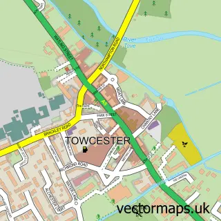
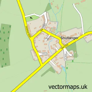
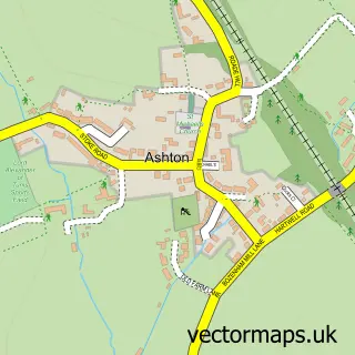
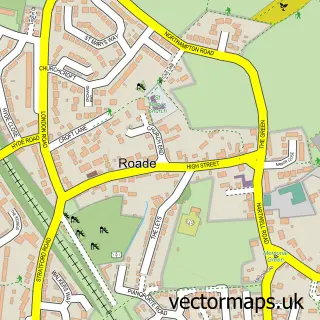
Nearby street map samples around Stoke Bruerne

More street maps in Northamptonshire
750 metre map area coverage
Boundary, postcode and point of interest information for the 750m x 750m rectangle centred on this sample map.
Boundaries containing map centre
Constituency: South Northamptonshire Co Const
District: West Northamptonshire
Icb: NHS Northamptonshire ICB
Parish: Stoke Bruerne CP
Police Force: northamptonshire
Postcode District: NN12
Postcode Sector: NN12 7
Ward: Hackleton & Roade Ward
Nearby boundaries intersecting sample
No additional intersecting boundaries found.
Postcode coverage
POI category counts
Pub: 4
Gardener: 2
History Museum: 2
Landmark And Historical Building: 2
Restaurant: 2
Arts And Crafts: 1
Asian Fusion Restaurant: 1
Bed And Breakfast: 1
Boat Tours: 1
Business: 1
Sample points of interest
- Manor Farm Wools
- Spice of Bruerne
- The Old Chapel Boutique B&B
- Stoke Bruerne Boat Company
- Everyday-Homeware
- Waterside Cafe
- The Home Farm CL
- St Mary the Virgin Church
- Stoke Bruerne Church of England Primary School
- Stoke Park Weddings
- Fire Born Forge
- Brocks of Bruerne
Create a larger editable map of Stoke Bruerne
This sample shows only a 750 metre area. To create a larger map of Stoke Bruerne, use our map builder to choose your own coverage area, add titles and download editable SVG, PDF and PNG files.
Create a custom map of Stoke Bruerne