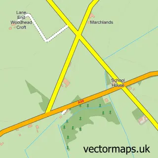
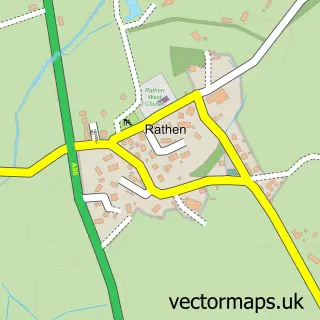
This Strichen street map is a detailed vector street map covering a 750m x 750m area. Select a larger area to create and download your own vector street map of Strichen.
The 750-metre map sample for Strichen covers 366 mapped buildings and approximately 21.9 km of road detail, of which 25 named roads are named. The immediate area includes 1 pub and 1 MOT station within 2 miles. The wider area around Strichen features 2 tourism points of interest, 6 food and drink venues and 1 hotel. To create a larger or custom map of Strichen, the map builder lets you define your own coverage area and download editable SVG, PDF and PNG files.
Create a larger editable map of Strichen
Choose any area you need and generate a high-quality vector map instantly. Perfect for print, planning, design, business and personal use.

This Strichen street map in Aberdeenshire is available as downloadable SVG, PDF and PNG map files, or as a printed map for planning, business, display, education, local information and design work. You can also create a larger custom map area using the map selector.
What this Strichen map sample shows
Strichen lies within Aberdeenshire parish, part of Central Buchan ward in the Aberdeenshire local authority area. The postcode geography for this area includes the AB postcode area, the AB43 postcode district and the AB43 6 postcode sector. Residents fall under the Grampian for NHS services.
Local features near Strichen
Within 2 milesAmenities and services in and around Strichen.
Administrative and postcode information for Strichen
Strichen lies within Aberdeenshire parish, part of Central Buchan ward in the Aberdeenshire local authority area. The postcode geography for this area includes the AB postcode area, the AB43 postcode district and the AB43 6 postcode sector. Residents fall under the Grampian for NHS services.
Nearby street map samples around Strichen

More street maps in Aberdeenshire
750 metre map area coverage
Boundary, postcode and point of interest information for the 750m x 750m rectangle centred on this sample map.
Boundaries containing map centre
Constituency: Aberdeenshire North and Moray East Co Const
District: Aberdeenshire
Icb: Grampian
Postcode District: AB43
Postcode Sector: AB43 6
Ward: Central Buchan Ward
Nearby boundaries intersecting sample
No additional intersecting boundaries found.
Postcode coverage
POI category counts
Convenience Store: 4
Butcher Shop: 3
Restaurant: 3
Cafe: 2
Church Cathedral: 2
Hair Salon: 2
Park: 2
Professional Services: 2
Shipping Center: 2
Accountant: 1
Sample points of interest
- Thrift Bookkeeping
- Strichen Antiques
- School Park
- The Cooperative Food Strichen, Strichen
- North East Firewood Supplies
- Bert Fowlie
- Bert Fowlie
- Herbert Fowlie
- Riverside Cafe and Coffee House
- The Willows Nibbly Pig Cafe and Gift Shop
- Mormond West Parish Church
- Strichen & Tyrie Parish Church
Create a larger editable map of Strichen
This sample shows only a 750 metre area. To create a larger map of Strichen, use our map builder to choose your own coverage area, add titles and download editable SVG, PDF and PNG files.
Create a custom map of Strichen