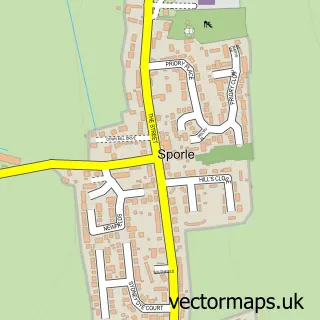
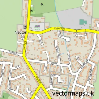
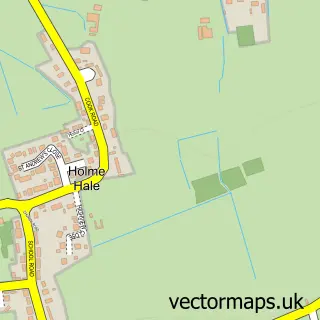
This Swaffham street map is a detailed vector street map covering a 750m x 750m area. Select a larger area to create and download your own vector street map of Swaffham.
The 750-metre map sample for Swaffham covers 456 mapped buildings and approximately 16.0 km of road detail, of which 31 named roads are named. The immediate area includes 1 school, 2 GP surgeries, with 3 within 2 miles, 3 pubs and 2 MOT stations, with 4 within 2 miles. The wider area around Swaffham features 2 tourism points of interest, 13 food and drink venues and 6 hotels. To create a larger or custom map of Swaffham, the map builder lets you define your own coverage area and download editable SVG, PDF and PNG files.
Create a larger editable map of Swaffham
Choose any area you need and generate a high-quality vector map instantly. Perfect for print, planning, design, business and personal use.

This Swaffham street map in Norfolk is available as downloadable SVG, PDF and PNG map files, or as a printed map for planning, business, display, education, local information and design work. You can also create a larger custom map area using the map selector.
What this Swaffham map sample shows
Swaffham lies within Swaffham Cp parish, part of Swaffham ward in the Breckland District local authority area. The postcode geography for this area includes the PE postcode area, the PE37 postcode district and the PE37 7 postcode sector. Residents fall under the Nhs Norfolk And Waveney Integrated Care Board for NHS services.
Local features near Swaffham
Within 2 milesAmenities and services in and around Swaffham.
Administrative and postcode information for Swaffham
Swaffham lies within Swaffham Cp parish, part of Swaffham ward in the Breckland District local authority area. The postcode geography for this area includes the PE postcode area, the PE37 postcode district and the PE37 7 postcode sector. Residents fall under the Nhs Norfolk And Waveney Integrated Care Board for NHS services.
Nearby street map samples around Swaffham

More street maps in Norfolk
750 metre map area coverage
Boundary, postcode and point of interest information for the 750m x 750m rectangle centred on this sample map.
Boundaries containing map centre
Constituency: South West Norfolk Co Const
County: Norfolk County
District: Breckland District
Icb: NHS Norfolk and Waveney ICB
Parish: Swaffham CP
Police Force: norfolk
Postcode District: PE37
Postcode Sector: PE37 7
Ward: Swaffham Ward
Nearby boundaries intersecting sample
Postcode Sector: PE37 8
Postcode coverage
POI category counts
Flowers And Gifts Shop: 7
Beauty Salon: 6
Hotel: 6
Church Cathedral: 5
Professional Services: 5
Restaurant: 5
Financial Service: 4
Hair Salon: 4
Anglican Church: 3
Automotive Repair: 3
Sample points of interest
- Grow Your Business East Anglia
- Hamilton Blake - Chartered Tax Advisers And Accountants
- Lighthouse Holistics
- Personal Evolution
- C Cheng
- Fountain of Life Church @ The Barn, Swaffham
- Swaffham
- Swaffham: St Peter & St Paul
- Shabby Tatt
- Hughes
- Parsons & Whittley Ltd.
- Revell Estate Agents
Create a larger editable map of Swaffham
This sample shows only a 750 metre area. To create a larger map of Swaffham, use our map builder to choose your own coverage area, add titles and download editable SVG, PDF and PNG files.
Create a custom map of Swaffham