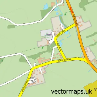
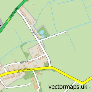
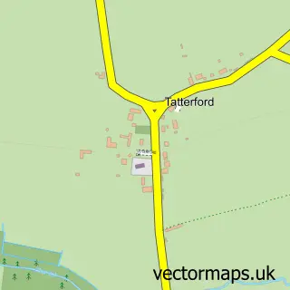
This Syderstone street map is a detailed vector street map covering a 750m x 750m area. Select a larger area to create and download your own vector street map of Syderstone.
The 750-metre map sample for Syderstone covers 144 mapped buildings and approximately 6.6 km of road detail, of which 5 named roads are named. The immediate area includes 1 pub and 1 MOT station within 2 miles. The wider area around Syderstone features 1 food and drink venue and 1 campsite within 2 miles. To create a larger or custom map of Syderstone, the map builder lets you define your own coverage area and download editable SVG, PDF and PNG files.
Create a larger editable map of Syderstone
Choose any area you need and generate a high-quality vector map instantly. Perfect for print, planning, design, business and personal use.

This Syderstone street map in Norfolk is available as downloadable SVG, PDF and PNG map files, or as a printed map for planning, business, display, education, local information and design work. You can also create a larger custom map area using the map selector.
What this Syderstone map sample shows
Syderstone lies within Syderstone Cp parish, part of Bircham With Rudhams ward in the King's Lynn And West Norfolk District (B) local authority area. The postcode geography for this area includes the PE postcode area, the PE31 postcode district and the PE31 8 postcode sector. Residents fall under the Nhs Norfolk And Waveney Integrated Care Board for NHS services.
Local features near Syderstone
Within 2 milesAmenities and services in and around Syderstone.
Administrative and postcode information for Syderstone
Syderstone lies within Syderstone Cp parish, part of Bircham With Rudhams ward in the King's Lynn And West Norfolk District (B) local authority area. The postcode geography for this area includes the PE postcode area, the PE31 postcode district and the PE31 8 postcode sector. Residents fall under the Nhs Norfolk And Waveney Integrated Care Board for NHS services.
Nearby street map samples around Syderstone

More street maps in Norfolk
750 metre map area coverage
Boundary, postcode and point of interest information for the 750m x 750m rectangle centred on this sample map.
Boundaries containing map centre
Constituency: North West Norfolk Co Const
County: Norfolk County
District: King's Lynn and West Norfolk District (B)
Icb: NHS Norfolk and Waveney ICB
Parish: Syderstone CP
Police Force: norfolk
Postcode District: PE31
Postcode Sector: PE31 8
Ward: Bircham with Rudhams Ward
Nearby boundaries intersecting sample
No additional intersecting boundaries found.
Postcode coverage
POI category counts
Anglican Church: 1
Automotive Repair: 1
Building Contractor: 1
Doctor: 1
Holiday Rental Home: 1
Kitchen Remodeling: 1
Landscaping: 1
Playground: 1
Post Office: 1
Pub: 1
Sample points of interest
- Church of Saint Mary, Syderstone
- Matthews Motor Services
- S1 Builders Norfolk
- The Norfolk Retreat
- Teacup Cottage Norfolk
- Kiddell Kitchens
- Challiscape Garden Design
- Syderstone Playground
- Post Office
- The Lynn Arms Pub
- Economy Storage
Create a larger editable map of Syderstone
This sample shows only a 750 metre area. To create a larger map of Syderstone, use our map builder to choose your own coverage area, add titles and download editable SVG, PDF and PNG files.
Create a custom map of Syderstone