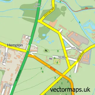
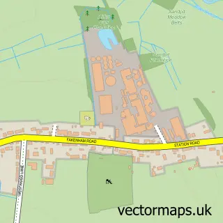
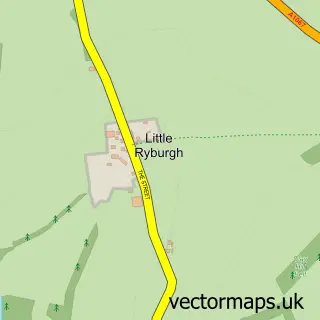
This Fakenham street map is a detailed vector street map covering a 750m x 750m area. Select a larger area to create and download your own vector street map of Fakenham.
The 750-metre map sample for Fakenham covers 303 mapped buildings and approximately 14.1 km of road detail, of which 30 named roads are named. The immediate area includes 1 school, 1 GP surgery within 2 miles, 4 pubs and 1 MOT station, with 7 within 2 miles. The wider area around Fakenham features 2 tourism points of interest, 17 food and drink venues and 5 hotels. To create a larger or custom map of Fakenham, the map builder lets you define your own coverage area and download editable SVG, PDF and PNG files.
Create a larger editable map of Fakenham
Choose any area you need and generate a high-quality vector map instantly. Perfect for print, planning, design, business and personal use.

This Fakenham street map in Norfolk is available as downloadable SVG, PDF and PNG map files, or as a printed map for planning, business, display, education, local information and design work. You can also create a larger custom map area using the map selector.
What this Fakenham map sample shows
Fakenham lies within Fakenham Cp parish, part of Lancaster South ward in the North Norfolk District local authority area. The postcode geography for this area includes the NR postcode area, the NR21 postcode district and the NR21 8 postcode sector. Residents fall under the Nhs Norfolk And Waveney Integrated Care Board for NHS services.
Local features near Fakenham
Within 2 milesAmenities and services in and around Fakenham.
Administrative and postcode information for Fakenham
Fakenham lies within Fakenham Cp parish, part of Lancaster South ward in the North Norfolk District local authority area. The postcode geography for this area includes the NR postcode area, the NR21 postcode district and the NR21 8 postcode sector. Residents fall under the Nhs Norfolk And Waveney Integrated Care Board for NHS services.
Nearby street map samples around Fakenham

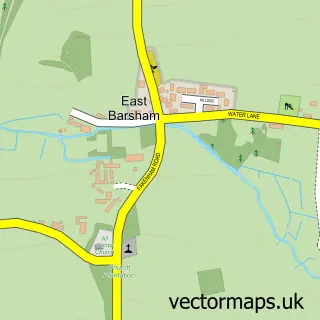
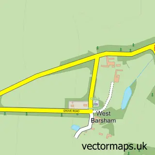
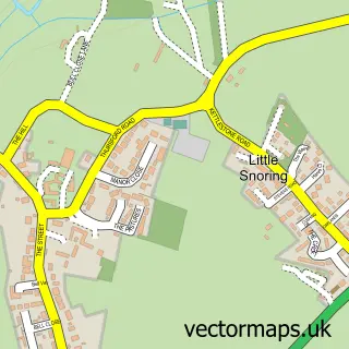
More street maps in Norfolk
750 metre map area coverage
Boundary, postcode and point of interest information for the 750m x 750m rectangle centred on this sample map.
Boundaries containing map centre
Constituency: Broadland and Fakenham Co Const
County: Norfolk County
District: North Norfolk District
Icb: NHS Norfolk and Waveney ICB
Parish: Fakenham CP
Police Force: norfolk
Postcode District: NR21
Postcode Sector: NR21 9
Ward: Lancaster South Ward
Nearby boundaries intersecting sample
Parish: Hempton CP, Pudding Norton CP
Postcode Sector: NR21 7, NR21 8
Ward: The Raynhams Ward
Postcode coverage
POI category counts
Beauty Salon: 10
Real Estate Agent: 9
Hair Salon: 7
Coffee Shop: 6
Bank Credit Union: 5
Clothing Store: 5
Fast Food Restaurant: 5
Gym: 5
Hotel: 5
Professional Services: 5
Sample points of interest
- Stephenson Smart Accountants
- Hayes & Storr
- Fakenham Osteopathic Clinic
- Fakenham: St Peter & St Paul
- Fakenham Antique Centre
- Fakenham Antiques & Collectables
- Fakenham Chapel Antiques
- Fakenham Chapel Antiques
- Hughes Electrical Ltd.
- Fakenham Gallery and Framers
- Venetia's Yarn Shop
- James Beck Auctions
Create a larger editable map of Fakenham
This sample shows only a 750 metre area. To create a larger map of Fakenham, use our map builder to choose your own coverage area, add titles and download editable SVG, PDF and PNG files.
Create a custom map of Fakenham