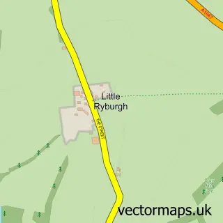
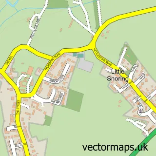
This Great Ryburgh street map is a detailed vector street map covering a 750m x 750m area. Select a larger area to create and download your own vector street map of Great Ryburgh.
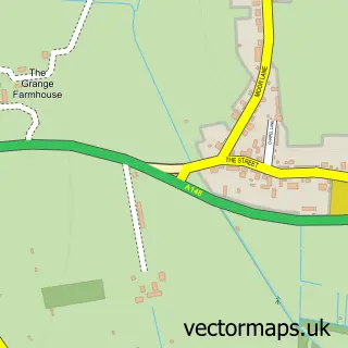
The 750-metre map sample for Great Ryburgh covers 150 mapped buildings and approximately 3.4 km of road detail, of which 3 named roads are named. The immediate area includes 1 MOT station within 2 miles. The wider area around Great Ryburgh features 1 hotel. To create a larger or custom map of Great Ryburgh, the map builder lets you define your own coverage area and download editable SVG, PDF and PNG files.
Create a larger editable map of Great Ryburgh
Choose any area you need and generate a high-quality vector map instantly. Perfect for print, planning, design, business and personal use.

This Great Ryburgh street map in Norfolk is available as downloadable SVG, PDF and PNG map files, or as a printed map for planning, business, display, education, local information and design work. You can also create a larger custom map area using the map selector.
What this Great Ryburgh map sample shows
Great Ryburgh lies within Ryburgh Cp parish, part of Stibbard ward in the North Norfolk District local authority area. The postcode geography for this area includes the NR postcode area, the NR21 postcode district and the NR21 0 postcode sector. Residents fall under the Nhs Norfolk And Waveney Integrated Care Board for NHS services.
Local features near Great Ryburgh
Within 2 milesAmenities and services in and around Great Ryburgh.
Administrative and postcode information for Great Ryburgh
Great Ryburgh lies within Ryburgh Cp parish, part of Stibbard ward in the North Norfolk District local authority area. The postcode geography for this area includes the NR postcode area, the NR21 postcode district and the NR21 0 postcode sector. Residents fall under the Nhs Norfolk And Waveney Integrated Care Board for NHS services.
Nearby street map samples around Great Ryburgh

More street maps in Norfolk
750 metre map area coverage
Boundary, postcode and point of interest information for the 750m x 750m rectangle centred on this sample map.
Boundaries containing map centre
Constituency: Broadland and Fakenham Co Const
County: Norfolk County
District: North Norfolk District
Icb: NHS Norfolk and Waveney ICB
Parish: Ryburgh CP
Police Force: norfolk
Postcode District: NR21
Postcode Sector: NR21 7
Ward: Stibbard Ward
Nearby boundaries intersecting sample
Postcode Sector: NR21 0
Postcode coverage
POI category counts
Post Office: 3
Beauty Salon: 1
Carpenter: 1
Clothing Store: 1
Community Center: 1
Convenience Store: 1
Engineering Services: 1
Hotel: 1
Laundry Services: 1
Liquor Store: 1
Sample points of interest
- Perfect 10
- Andrew Bolton Carpentry
- Burr's Workshop
- Ryburgh Memorial Hall & Playing Field
- Ryburgh Village Shop and Post Office
- Charles Roberts And Sons
- The Blue Boar Inn
- Perfectly Pressed
- Crisp Malt
- Great Ryburgh Post Office
- Post Office
- Post Office-Great Ryburgh
Create a larger editable map of Great Ryburgh
This sample shows only a 750 metre area. To create a larger map of Great Ryburgh, use our map builder to choose your own coverage area, add titles and download editable SVG, PDF and PNG files.
Create a custom map of Great Ryburgh