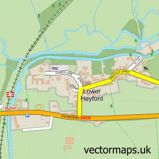
This Tackley street map is a detailed vector street map covering a 750m x 750m area. Select a larger area to create and download your own vector street map of Tackley.
The 750-metre map sample for Tackley covers 310 mapped buildings and approximately 22.7 km of road detail, of which 19 named roads are named. The immediate area includes 1 school, 1 railway station, 1 pub and 1 MOT station within 2 miles. The wider area around Tackley features 3 food and drink venues and 1 campsite within 2 miles. To create a larger or custom map of Tackley, the map builder lets you define your own coverage area and download editable SVG, PDF and PNG files.
Create a larger editable map of Tackley
Choose any area you need and generate a high-quality vector map instantly. Perfect for print, planning, design, business and personal use.

This Tackley street map in Oxfordshire is available as downloadable SVG, PDF and PNG map files, or as a printed map for planning, business, display, education, local information and design work. You can also create a larger custom map area using the map selector.
What this Tackley map sample shows
Tackley lies within Tackley Cp parish, part of Stonesfield And Tackley ward in the West Oxfordshire District local authority area. The postcode geography for this area includes the OX postcode area, the OX5 postcode district and the OX5 3 postcode sector. Residents fall under the Nhs Buckinghamshire, Oxfordshire And Berkshire West Integrated Care Board for NHS services.
Local features near Tackley
Within 2 milesAmenities and services in and around Tackley.
Administrative and postcode information for Tackley
Tackley lies within Tackley Cp parish, part of Stonesfield And Tackley ward in the West Oxfordshire District local authority area. The postcode geography for this area includes the OX postcode area, the OX5 postcode district and the OX5 3 postcode sector. Residents fall under the Nhs Buckinghamshire, Oxfordshire And Berkshire West Integrated Care Board for NHS services.
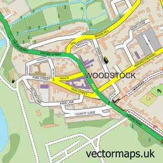
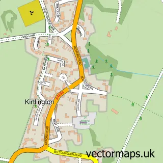
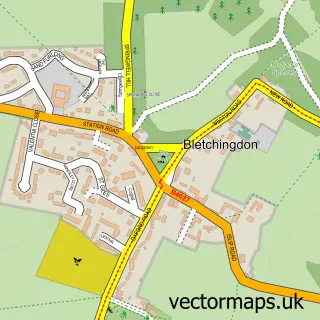
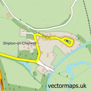
Nearby street map samples around Tackley


More street maps in Oxfordshire
750 metre map area coverage
Boundary, postcode and point of interest information for the 750m x 750m rectangle centred on this sample map.
Boundaries containing map centre
Constituency: Bicester and Woodstock Co Const
County: Oxfordshire County
District: West Oxfordshire District
Icb: NHS Thames Valley ICB
Parish: Tackley CP
Police Force: thames valley
Postcode District: OX5
Postcode Sector: OX5 3
Ward: Stonesfield and Tackley Ward
Nearby boundaries intersecting sample
No additional intersecting boundaries found.
Postcode coverage
POI category counts
Building Supply Store: 2
Automotive Services And Repair: 1
Bar: 1
Bed And Breakfast: 1
Cafe: 1
Carpenter: 1
Coffee Shop: 1
Community Center: 1
Cooking School: 1
Corporate Office: 1
Sample points of interest
- Macfaction
- The Oxford Bar Company
- Colliers B & B
- Carpet Cleaning Farnham
- Hills Services
- Tackley Viilage Shop, Post Office and Tackley Cafe
- Good Wood Carpentry
- Classic Commer Coffee
- Tackley Village Hall
- Mariella Bliss - Blissful Italian food
- Jacquie Stone Designs
- Massage & Sports Therapist
Create a larger editable map of Tackley
This sample shows only a 750 metre area. To create a larger map of Tackley, use our map builder to choose your own coverage area, add titles and download editable SVG, PDF and PNG files.
Create a custom map of Tackley