Vector Maps logo
Home Why it works Popular maps Districts Samples Customizer Create Your Map
VectorMaps.uk
Home Popular maps Districts Samples Customizer Create Your Map Privacy Disclaimer
Home / UK Maps / Ross and Cromarty / Tain Map

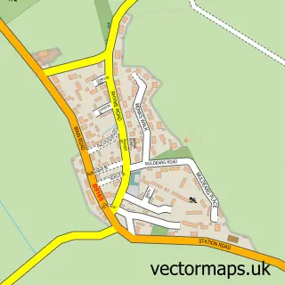
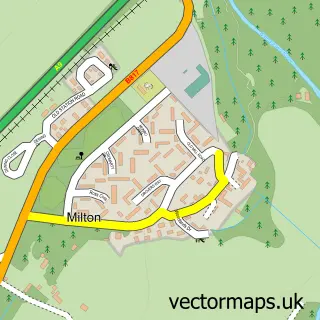
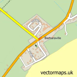
This Tain street map is a detailed vector street map covering a 750m x 750m area. Select a larger area to create and download your own vector street map of Tain.

Tain is a town in Ross And Cromarty, in the Highlands And Islands of Scotland. The settlement falls within the Caithness, Sutherland And Easter Ross parliamentary constituency. It is served by the IV19 postcode district, with IV19 1 as the local postcode

The 750-metre map sample for Tain covers 205 mapped buildings and approximately 22.4 km of road detail, of which 56 named roads are named. The immediate area includes 1 railway station, 2 GP surgeries within 2 miles, 1 pub and 1 MOT station, with 2 within 2 miles. The wider area around Tain features 2 tourism points of interest, 10 food and drink venues and 5 hotels. To create a larger or custom map of Tain, the map builder lets you define your own coverage area and download editable SVG, PDF and PNG files.

205Buildings
22.4 kmRoads
56Named roads
0Residents within 2 miles
Create your own

Create a larger editable map of Tain

Choose any area you need and generate a high-quality vector map instantly. Perfect for print, planning, design, business and personal use.

Choose any location
Editable SVG files
Any size up to A0
PDF, PNG & more
Instant download
High quality guaranteed
Create My Custom Map
Secure, private & no credit card required
Tain Vector Street Map
750m Sample
Tain vector street map sample showing roads, buildings and local features in a 750 metre preview area
Buy Tain Map Print from £12.95 Buy Tain Digital Map from £6

This Tain street map in Ross and Cromarty is available as downloadable SVG, PDF and PNG map files, or as a printed map for planning, business, display, education, local information and design work. You can also create a larger custom map area using the map selector.

What this Tain map sample shows

Tain lies within Highland parish, part of Tain And Easter Ross ward in the Highland local authority area. The postcode geography for this area includes the IV postcode area, the IV19 postcode district and the IV19 1 postcode sector. Residents fall under the Highland for NHS services.

Local features near Tain

Within 2 miles

Amenities and services in and around Tain.

1 Railway stations
2 GP surgeries within 2 miles
1 MOT stations 2 within 2 miles
2 Tourism & leisure
10 Food & drink
1 Pubs
5 Hotels
3 Healthcare POIs
1 Vehicle services

Counts are approximate and based on publicly available data.

Administrative and postcode information for Tain

The local authority covering Tain is Highland, within the county of Ross And Cromarty. The settlement lies within Tain And Easter Ross ward and Highland civil parish. The IV19 postcode district and IV19 1 postcode sector serve the immediate area. NHS provision in the area is delivered through Highland.

Parish HIGHLAND
Ward Tain and Easter Ross
District / local authority Highland
County Ross and Cromarty
Historic county Ross and Cromarty
Postcode district IV19
Postcode sector IV19 1
Parliamentary constituency Caithness, Sutherland and Easter Ross
Region Highlands and Islands
Country Scotland

Nearby street map samples around Tain

Street map sample of Inverness, Inverness Inverness City - Inverness - 23.9 miles Street map sample of Hill of Fearn, Ross and Cromarty Hill of Fearn Village - Ross and Cromarty - 4.2 miles Street map sample of Kildary, Ross and Cromarty Kildary Village - Ross and Cromarty - 4.5 miles Street map sample of Edderton, Ross and Cromarty Edderton Village - Ross and Cromarty - 4.5 miles Street map sample of Fearn, Ross and Cromarty Fearn Village - Ross and Cromarty - 4.7 miles Street map sample of Milton, Ross and Cromarty Milton Village - Ross and Cromarty - 5.0 miles Street map sample of Clashmore, Sutherland Clashmore Village - Sutherland - 5.1 miles Street map sample of Inver, Ross and Cromarty Inver Village - Ross and Cromarty - 5.1 miles Street map sample of Evelix, Sutherland Evelix Village - Sutherland - 5.3 miles Street map sample of Barbaraville, Ross and Cromarty Barbaraville Village - Ross and Cromarty - 6.4 miles

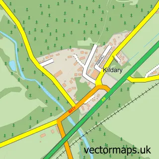
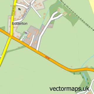
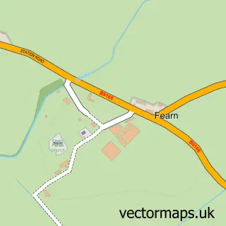
More street maps in Ross and Cromarty

Street map sample of Hill of Fearn, Ross and Cromarty Hill of Fearn Village - 4.2 miles Street map sample of Kildary, Ross and Cromarty Kildary Village - 4.5 miles Street map sample of Edderton, Ross and Cromarty Edderton Village - 4.5 miles Street map sample of Fearn, Ross and Cromarty Fearn Village - 4.7 miles Street map sample of Milton, Ross and Cromarty Milton Village - 5.0 miles

750 metre map area coverage

Boundary, postcode and point of interest information for the 750m x 750m rectangle centred on this sample map.

Boundaries containing map centre

Constituency: Caithness, Sutherland and Easter Ross Co Const

District: Highland

Icb: Highland

Postcode District: IV19

Postcode Sector: IV19 1

Ward: Tain and Easter Ross Ward

Nearby boundaries intersecting sample

No additional intersecting boundaries found.

Postcode coverage

IV19 IV19 1

POI category counts

Hotel: 5

Bank Credit Union: 4

Bed And Breakfast: 4

Church Cathedral: 4

Restaurant: 4

Arts And Crafts: 3

Bakery: 3

Beauty And Spa: 3

Beauty Salon: 3

Coffee Shop: 3

Sample points of interest

  • Audacia Ltd Accountant
  • Alternatives Acupuncture
  • Cheeky Highlander - Tain Antique Store
  • Blueprint Architecture Architectural Designer
  • Northcoastglass Art Gallery
  • Studio Smith Tain Art Gallery
  • Lesley Mackenzie Ceramics Arts And Crafts
  • Tarlogie Arts And Crafts
  • The Art Room Tain Arts And Crafts
  • Top Tain Curry Club Asian Restaurant
  • The Cooperative Food (BF) Tain - High Street Atms
  • Longlac Valeting Services Auto Detailing

Create a larger editable map of Tain

This sample shows only a 750 metre area. To create a larger map of Tain, use our map builder to choose your own coverage area, add titles and download editable SVG, PDF and PNG files.

Create a custom map of Tain

Phone 01751 473136 | Copyright Vectormaps.uk 2026

Samples Customizer Privacy Disclaimer
Tain Vector Street Map
Tain enlarged street map sample showing a 750 metre preview area