Vector Maps logo
Home Why it works Popular maps Districts Samples Customizer Create Your Map
VectorMaps.uk
Home Popular maps Districts Samples Customizer Create Your Map Privacy Disclaimer
Home / UK Maps / Ross and Cromarty / Hill of Fearn Map

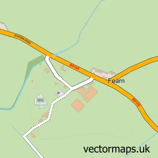
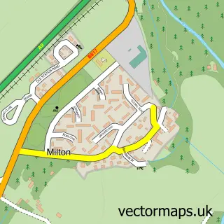
This Hill of Fearn street map is a detailed vector street map covering a 750m x 750m area. Select a larger area to create and download your own vector street map of Hill of Fearn.

Hill of Fearn is a village in Ross And Cromarty, in the Highlands And Islands of Scotland. The settlement falls within the Caithness, Sutherland And Easter Ross parliamentary constituency. It is served by the IV20 postcode district, with IV20 1 as the loc

The 750-metre map sample for Hill of Fearn covers 77 mapped buildings and approximately 8.7 km of road detail, of which 14 named roads are named. The immediate area includes 1 MOT station. The wider area around Hill of Fearn features 3 tourism points of interest. To create a larger or custom map of Hill of Fearn, the map builder lets you define your own coverage area and download editable SVG, PDF and PNG files.

77Buildings
8.73 kmRoads
14Named roads
0Residents within 2 miles
Create your own

Create a larger editable map of Hill of Fearn

Choose any area you need and generate a high-quality vector map instantly. Perfect for print, planning, design, business and personal use.

Choose any location
Editable SVG files
Any size up to A0
PDF, PNG & more
Instant download
High quality guaranteed
Create My Custom Map
Secure, private & no credit card required
Hill of Fearn Vector Street Map
750m Sample
Hill of Fearn vector street map sample showing roads, buildings and local features in a 750 metre preview area
Buy Hill of Fearn Map Print from £12.95 Buy Hill of Fearn Digital Map from £6

This Hill of Fearn street map in Ross and Cromarty is available as downloadable SVG, PDF and PNG map files, or as a printed map for planning, business, display, education, local information and design work. You can also create a larger custom map area using the map selector.

What this Hill of Fearn map sample shows

Hill of Fearn lies within Highland parish, part of Tain And Easter Ross ward in the Highland local authority area. The postcode geography for this area includes the IV postcode area, the IV20 postcode district and the IV20 1 postcode sector. Residents fall under the Highland for NHS services.

Local features near Hill of Fearn

Within 2 miles

Amenities and services in and around Hill of Fearn.

1 MOT stations 1 within 2 miles
3 Tourism & leisure

Counts are approximate and based on publicly available data.

Administrative and postcode information for Hill of Fearn

The local authority covering Hill of Fearn is Highland, within the county of Ross And Cromarty. The settlement lies within Tain And Easter Ross ward and Highland civil parish. The IV20 postcode district and IV20 1 postcode sector serve the immediate area. NHS provision in the area is delivered through Highland.

Parish HIGHLAND
Ward Tain and Easter Ross
District / local authority Highland
County Ross and Cromarty
Historic county Ross and Cromarty
Postcode district IV20
Postcode sector IV20 1
Parliamentary constituency Caithness, Sutherland and Easter Ross
Region Highlands and Islands
Country Scotland

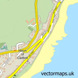
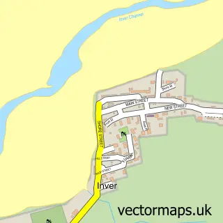
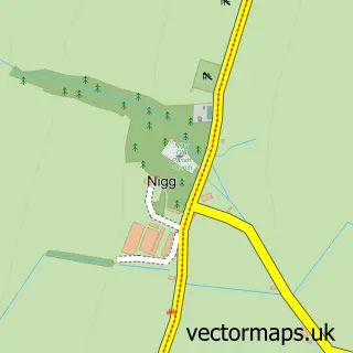
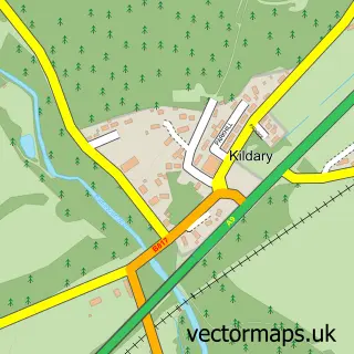
Nearby street map samples around Hill of Fearn

Street map sample of Tain, Ross and Cromarty Tain Town - Ross and Cromarty - 4.2 miles Street map sample of Inverness, Inverness Inverness City - Inverness - 22.7 miles Street map sample of Fearn, Ross and Cromarty Fearn Village - Ross and Cromarty - 0.5 miles Street map sample of Balintore, Ross and Cromarty Balintore Village - Ross and Cromarty - 2.3 miles Street map sample of Shandwick, Ross and Cromarty Shandwick Village - Ross and Cromarty - 2.4 miles Street map sample of Hilton of Cadboll, Ross and Cromarty Hilton of Cadboll Village - Ross and Cromarty - 2.6 miles Street map sample of Inver, Ross and Cromarty Inver Village - Ross and Cromarty - 3.5 miles Street map sample of Nigg, Ross and Cromarty Nigg Village - Ross and Cromarty - 4.3 miles Street map sample of Kildary, Ross and Cromarty Kildary Village - Ross and Cromarty - 4.5 miles Street map sample of Milton, Ross and Cromarty Milton Village - Ross and Cromarty - 4.7 miles

More street maps in Ross and Cromarty

Street map sample of Fearn, Ross and Cromarty Fearn Village - 0.5 miles Street map sample of Balintore, Ross and Cromarty Balintore Village - 2.3 miles Street map sample of Shandwick, Ross and Cromarty Shandwick Village - 2.4 miles Street map sample of Hilton of Cadboll, Ross and Cromarty Hilton of Cadboll Village - 2.6 miles Street map sample of Inver, Ross and Cromarty Inver Village - 3.5 miles

750 metre map area coverage

Boundary, postcode and point of interest information for the 750m x 750m rectangle centred on this sample map.

Boundaries containing map centre

Constituency: Caithness, Sutherland and Easter Ross Co Const

District: Highland

Icb: Highland

Postcode District: IV20

Postcode Sector: IV20 1

Ward: Tain and Easter Ross Ward

Nearby boundaries intersecting sample

No additional intersecting boundaries found.

Postcode coverage

IV20 IV20 1

POI category counts

Business Management Services: 2

Landmark And Historical Building: 2

Airport: 1

Antique Store: 1

Attractions And Activities: 1

Beauty Salon: 1

Butcher Shop: 1

Farm: 1

Flowers And Gifts Shop: 1

Taxi Service: 1

Sample points of interest

  • Easter Airfield Airport
  • Fearn Antiques & Vintage Postcard Emporium Antique Store
  • Fearn Free Food Garden Attractions And Activities
  • Vie Beauty Beauty Salon
  • Fearn Post Office Business Management Services
  • Post Office-Fearn Business Management Services
  • Highland Prime Butcher Shop
  • J Mackenzie & Son Lower Geanies Farm
  • Crafty Burd Flowers And Gifts Shop
  • Fearn Landmark And Historical Building
  • Hill of Fearn Landmark And Historical Building
  • DPTaxi Tain and Dornoch Taxi Service

Create a larger editable map of Hill of Fearn

This sample shows only a 750 metre area. To create a larger map of Hill of Fearn, use our map builder to choose your own coverage area, add titles and download editable SVG, PDF and PNG files.

Create a custom map of Hill of Fearn

Phone 01751 473136 | Copyright Vectormaps.uk 2026

Samples Customizer Privacy Disclaimer
Hill of Fearn Vector Street Map
Hill of Fearn enlarged street map sample showing a 750 metre preview area