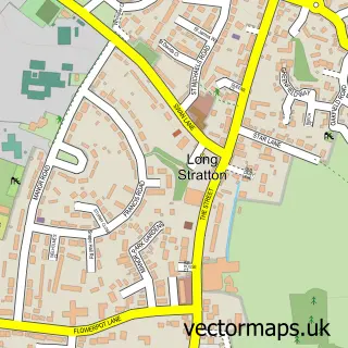
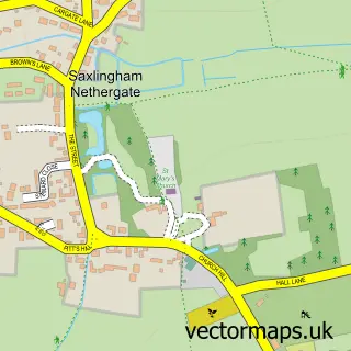
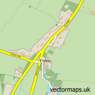
This Tasburgh street map is a detailed vector street map covering a 750m x 750m area. Select a larger area to create and download your own vector street map of Tasburgh.
The 750-metre map sample for Tasburgh covers 295 mapped buildings and approximately 14.6 km of road detail, of which 22 named roads are named. The immediate area includes 1 school, 1 GP surgery within 2 miles, 1 pub and 2 MOT stations within 2 miles. The wider area around Tasburgh features 2 food and drink venues. To create a larger or custom map of Tasburgh, the map builder lets you define your own coverage area and download editable SVG, PDF and PNG files.
Create a larger editable map of Tasburgh
Choose any area you need and generate a high-quality vector map instantly. Perfect for print, planning, design, business and personal use.

This Tasburgh street map in Norfolk is available as downloadable SVG, PDF and PNG map files, or as a printed map for planning, business, display, education, local information and design work. You can also create a larger custom map area using the map selector.
What this Tasburgh map sample shows
Tasburgh lies within Tasburgh Cp parish, part of Hempnall ward in the South Norfolk District local authority area. The postcode geography for this area includes the NR postcode area, the NR15 postcode district and the NR15 1 postcode sector. Residents fall under the Nhs Norfolk And Waveney Integrated Care Board for NHS services.
Local features near Tasburgh
Within 2 milesAmenities and services in and around Tasburgh.
Administrative and postcode information for Tasburgh
Tasburgh lies within Tasburgh Cp parish, part of Hempnall ward in the South Norfolk District local authority area. The postcode geography for this area includes the NR postcode area, the NR15 postcode district and the NR15 1 postcode sector. Residents fall under the Nhs Norfolk And Waveney Integrated Care Board for NHS services.
Nearby street map samples around Tasburgh

More street maps in Norfolk
750 metre map area coverage
Boundary, postcode and point of interest information for the 750m x 750m rectangle centred on this sample map.
Boundaries containing map centre
Constituency: South Norfolk Co Const
County: Norfolk County
District: South Norfolk District
Icb: NHS Norfolk and Waveney ICB
Parish: Tasburgh CP
Police Force: norfolk
Postcode District: NR15
Postcode Sector: NR15 1
Ward: Hempnall Ward
Nearby boundaries intersecting sample
Parish: Long Stratton CP
Ward: Stratton Ward
Postcode coverage
POI category counts
Gardener: 2
Advertising Agency: 1
Business Management Services: 1
Church Cathedral: 1
Coffee Shop: 1
Counseling And Mental Health: 1
Elementary School: 1
Florist: 1
Hvac Services: 1
It Service And Computer Repair: 1
Sample points of interest
- Digital Sign Fx
- Yoursorted com Ltd.
- Saint Mary the Virgin Tasburgh
- Foundry Plant Centre & Coffee Shop
- beyounow
- Preston Primary School
- Peony Floral Design
- B B Gardening Services
- Green Lawn Care
- Simeco Ltd
- Deltasoft
- Anglia Radio
Create a larger editable map of Tasburgh
This sample shows only a 750 metre area. To create a larger map of Tasburgh, use our map builder to choose your own coverage area, add titles and download editable SVG, PDF and PNG files.
Create a custom map of Tasburgh