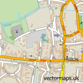
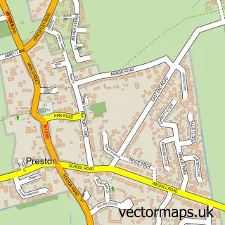
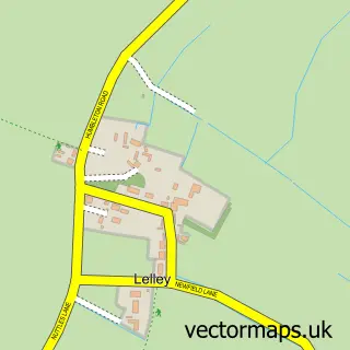
This Thorngumbald street map is a detailed vector street map covering a 750m x 750m area. Select a larger area to create and download your own vector street map of Thorngumbald.
The 750-metre map sample for Thorngumbald covers 425 mapped buildings and approximately 14.9 km of road detail, of which 20 named roads are named. The immediate area includes 3 pubs and 2 MOT stations within 2 miles. The wider area around Thorngumbald features 1 tourism point of interest, 4 food and drink venues and 1 hotel. To create a larger or custom map of Thorngumbald, the map builder lets you define your own coverage area and download editable SVG, PDF and PNG files.
Create a larger editable map of Thorngumbald
Choose any area you need and generate a high-quality vector map instantly. Perfect for print, planning, design, business and personal use.

This Thorngumbald street map in East Riding of Yorkshire is available as downloadable SVG, PDF and PNG map files, or as a printed map for planning, business, display, education, local information and design work. You can also create a larger custom map area using the map selector.
What this Thorngumbald map sample shows
Thorngumbald lies within Thorngumbald Cp parish, part of South West Holderness ward in the East Riding Of Yorkshire local authority area. The postcode geography for this area includes the HU postcode area, the HU12 postcode district and the HU12 9 postcode sector. Residents fall under the Nhs Humber And North Yorkshire Integrated Care Board for NHS services.
Local features near Thorngumbald
Within 2 milesAmenities and services in and around Thorngumbald.
Administrative and postcode information for Thorngumbald
The local authority covering Thorngumbald is East Riding Of Yorkshire, within the county of East Riding Of Yorkshire. The settlement lies within South West Holderness ward and Thorngumbald Cp civil parish. The HU12 postcode district and HU12 9 postcode sector serve the immediate area. NHS provision in the area is delivered through Hull University Teaching Hospitals Nhs Trust.
Nearby street map samples around Thorngumbald

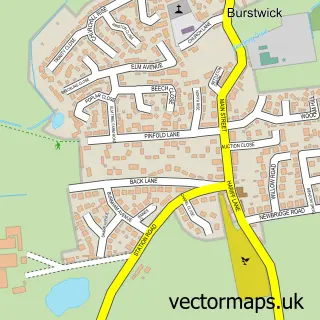
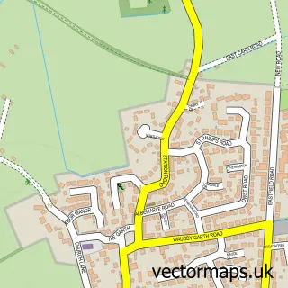
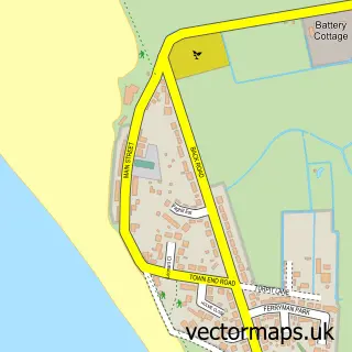
More street maps in East Riding of Yorkshire
750 metre map area coverage
Boundary, postcode and point of interest information for the 750m x 750m rectangle centred on this sample map.
Boundaries containing map centre
Constituency: Beverley and Holderness Co Const
District: East Riding of Yorkshire
Icb: NHS Humber and North Yorkshire ICB
Parish: Thorngumbald CP
Police Force: humberside
Postcode District: HU12
Postcode Sector: HU12 9
Ward: South West Holderness Ward
Nearby boundaries intersecting sample
No additional intersecting boundaries found.
Postcode coverage
POI category counts
Hair Salon: 3
Pub: 3
Convenience Store: 2
Electrician: 2
Grocery Store: 2
Key And Locksmith: 2
Anglican Church: 1
Atms: 1
Beauty And Spa: 1
Cafe: 1
Sample points of interest
- St. Mary, Thorngumbald
- PayPoint
- The Sisu Studio
- Thornbirds Cafe
- Royal China Takeaway
- Thorngumbald Village Hall
- Yorkshire Demolition
- Co-op Food
- SPAR Thorngumbald
- Evri ParcelShop
- Sheila Mills
- Dennis Craven S.O.M
Create a larger editable map of Thorngumbald
This sample shows only a 750 metre area. To create a larger map of Thorngumbald, use our map builder to choose your own coverage area, add titles and download editable SVG, PDF and PNG files.
Create a custom map of Thorngumbald