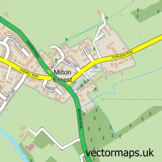
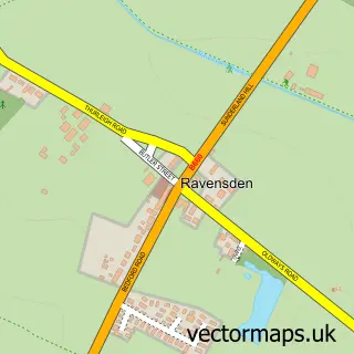
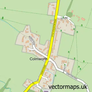
This Thurleigh street map is a detailed vector street map covering a 750m x 750m area. Select a larger area to create and download your own vector street map of Thurleigh.
The 750-metre map sample for Thurleigh covers 131 mapped buildings and approximately 6.9 km of road detail, of which 6 named roads are named. The immediate area includes 1 school and 1 MOT station within 2 miles. The wider area around Thurleigh features 2 tourism points of interest. To create a larger or custom map of Thurleigh, the map builder lets you define your own coverage area and download editable SVG, PDF and PNG files.
Create a larger editable map of Thurleigh
Choose any area you need and generate a high-quality vector map instantly. Perfect for print, planning, design, business and personal use.

This Thurleigh street map in Bedfordshire is available as downloadable SVG, PDF and PNG map files, or as a printed map for planning, business, display, education, local information and design work. You can also create a larger custom map area using the map selector.
What this Thurleigh map sample shows
Thurleigh lies within Thurleigh Cp parish, part of Riseley ward in the Bedford (B) local authority area. The postcode geography for this area includes the MK postcode area, the MK44 postcode district and the MK44 2 postcode sector. Residents fall under the Nhs Bedfordshire, Luton And Milton Keynes Integrated Care Board for NHS services.
Local features near Thurleigh
Within 2 milesAmenities and services in and around Thurleigh.
Administrative and postcode information for Thurleigh
The local authority covering Thurleigh is Bedford (B), within the county of Bedfordshire. The settlement lies within Riseley ward and Thurleigh Cp civil parish. The MK44 postcode district and MK44 2 postcode sector serve the immediate area. NHS provision in the area is delivered through Bedfordshire Hospitals Nhs Foundation Trust.
Nearby street map samples around Thurleigh

More street maps in Bedfordshire
750 metre map area coverage
Boundary, postcode and point of interest information for the 750m x 750m rectangle centred on this sample map.
Boundaries containing map centre
Constituency: North Bedfordshire Co Const
District: Bedford (B)
Icb: NHS Central East ICB
Parish: Thurleigh CP
Police Force: bedfordshire
Postcode District: MK44
Postcode Sector: MK44 2
Ward: Riseley Ward
Nearby boundaries intersecting sample
No additional intersecting boundaries found.
Postcode coverage
POI category counts
Elementary School: 2
Anglican Church: 1
Car Dealer: 1
Carpet Cleaning: 1
Castle: 1
Chocolatier: 1
Community Center: 1
Financial Service: 1
It Service And Computer Repair: 1
Landmark And Historical Building: 1
Sample points of interest
- St Peter's Church, Thurleigh
- Discovery MPV
- Andrew Blair Professional Carpet and Upholstery Cleaning
- Thurleigh Castle
- The Old Chapel Cake Company
- Thurleigh Village Hall
- Thurleigh Primary School
- Thurleigh Primary School
- Sba Bedford
- D P Systems
- Thurleigh
- Thurleigh Tang Soo Do
Create a larger editable map of Thurleigh
This sample shows only a 750 metre area. To create a larger map of Thurleigh, use our map builder to choose your own coverage area, add titles and download editable SVG, PDF and PNG files.
Create a custom map of Thurleigh