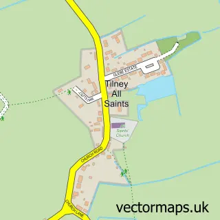
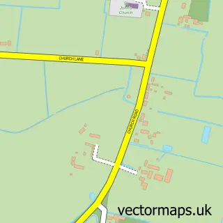
This Tilney High End street map is a detailed vector street map covering a 750m x 750m area. Select a larger area to create and download your own vector street map of Tilney High End.
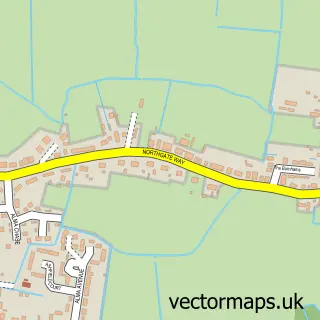
The 750-metre map sample for Tilney High End covers 103 mapped buildings and approximately 10.3 km of road detail, of which 7 named roads are named. The immediate area includes 1 school and 2 MOT stations within 2 miles. The wider area around Tilney High End features 1 food and drink venue. To create a larger or custom map of Tilney High End, the map builder lets you define your own coverage area and download editable SVG, PDF and PNG files.
Create a larger editable map of Tilney High End
Choose any area you need and generate a high-quality vector map instantly. Perfect for print, planning, design, business and personal use.

This Tilney High End street map in Norfolk is available as downloadable SVG, PDF and PNG map files, or as a printed map for planning, business, display, education, local information and design work. You can also create a larger custom map area using the map selector.
What this Tilney High End map sample shows
Tilney High End lies within Tilney All Saints Cp parish, part of Clenchwarton ward in the King's Lynn And West Norfolk District (B) local authority area. The postcode geography for this area includes the PE postcode area, the PE34 postcode district and the PE34 4 postcode sector. Residents fall under the Nhs Norfolk And Waveney Integrated Care Board for NHS services.
Local features near Tilney High End
Within 2 milesAmenities and services in and around Tilney High End.
Administrative and postcode information for Tilney High End
Tilney High End lies within Tilney All Saints Cp parish, part of Clenchwarton ward in the King's Lynn And West Norfolk District (B) local authority area. The postcode geography for this area includes the PE postcode area, the PE34 postcode district and the PE34 4 postcode sector. Residents fall under the Nhs Norfolk And Waveney Integrated Care Board for NHS services.
Nearby street map samples around Tilney High End

More street maps in Norfolk
750 metre map area coverage
Boundary, postcode and point of interest information for the 750m x 750m rectangle centred on this sample map.
Boundaries containing map centre
Constituency: North West Norfolk Co Const
County: Norfolk County
District: King's Lynn and West Norfolk District (B)
Icb: NHS Norfolk and Waveney ICB
Parish: Tilney All Saints CP
Police Force: norfolk
Postcode District: PE34
Postcode Sector: PE34 4
Ward: Clenchwarton Ward
Nearby boundaries intersecting sample
Constituency: South West Norfolk Co Const
Parish: Tilney St. Lawrence CP
Ward: Tilney, Mershe Lande & Wiggenhall Ward
Postcode coverage
POI category counts
Active Life: 1
Bar And Grill Restaurant: 1
Building Supply Store: 1
Charity Organization: 1
Elementary School: 1
Golf Course: 1
Gym: 1
Painting: 1
Rental Service: 1
Restaurant: 1
Sample points of interest
- FootGolf
- Jamie's Bar & Grill
- N B Construction UK
- CDH UK - The Congenital Diaphragmatic Hernia Charity
- Tilney All Saints Voluntary Controlled Primary School
- Eagles Golf Centre
- Lynn Sport Kings Lynn
- MT Painter & Decorators
- King of the Castle
- Jamie's Bar & Grill
- Skylarks Pre-School
- Tilney Sports
Create a larger editable map of Tilney High End
This sample shows only a 750 metre area. To create a larger map of Tilney High End, use our map builder to choose your own coverage area, add titles and download editable SVG, PDF and PNG files.
Create a custom map of Tilney High End