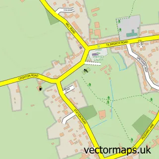
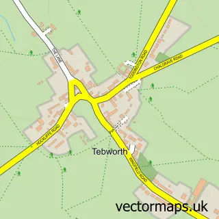
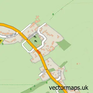
This Tilsworth street map is a detailed vector street map covering a 750m x 750m area. Select a larger area to create and download your own vector street map of Tilsworth.
The 750-metre map sample for Tilsworth covers 149 mapped buildings and approximately 7.5 km of road detail, of which 6 named roads are named. The immediate area includes 1 pub and 3 MOT stations within 2 miles. The wider area around Tilsworth features 1 food and drink venue. To create a larger or custom map of Tilsworth, the map builder lets you define your own coverage area and download editable SVG, PDF and PNG files.
Create a larger editable map of Tilsworth
Choose any area you need and generate a high-quality vector map instantly. Perfect for print, planning, design, business and personal use.

This Tilsworth street map in Bedfordshire is available as downloadable SVG, PDF and PNG map files, or as a printed map for planning, business, display, education, local information and design work. You can also create a larger custom map area using the map selector.
What this Tilsworth map sample shows
Tilsworth lies within Tilsworth Cp parish, part of Heath And Reach ward in the Central Bedfordshire local authority area. The postcode geography for this area includes the LU postcode area, the LU7 postcode district and the LU7 9 postcode sector. Residents fall under the Nhs Bedfordshire, Luton And Milton Keynes Integrated Care Board for NHS services.
Local features near Tilsworth
Within 2 milesAmenities and services in and around Tilsworth.
Administrative and postcode information for Tilsworth
Tilsworth lies within Tilsworth Cp parish, part of Heath And Reach ward in the Central Bedfordshire local authority area. The postcode geography for this area includes the LU postcode area, the LU7 postcode district and the LU7 9 postcode sector. Residents fall under the Nhs Bedfordshire, Luton And Milton Keynes Integrated Care Board for NHS services.
Nearby street map samples around Tilsworth

More street maps in Bedfordshire
750 metre map area coverage
Boundary, postcode and point of interest information for the 750m x 750m rectangle centred on this sample map.
Boundaries containing map centre
Constituency: Dunstable and Leighton Buzzard Co Const
District: Central Bedfordshire
Icb: NHS Central East ICB
Parish: Tilsworth CP
Police Force: bedfordshire
Postcode District: LU7
Postcode Sector: LU7 9
Ward: Heath & Reach Ward
Nearby boundaries intersecting sample
No additional intersecting boundaries found.
Postcode coverage
POI category counts
Building Supply Store: 3
Arts And Entertainment: 1
Bartender: 1
Business Manufacturing And Supply: 1
Church Cathedral: 1
Contractor: 1
Driving School: 1
Gardener: 1
Golf Club: 1
Gym: 1
Sample points of interest
- Razz
- Jockey Bar
- A1 Scaffolding
- G H Stoneworks
- Leighway Brickwork
- Everfarm Turf
- Hope Church South Bedfordshire
- Goldleaf Groundcare
- Straight on Driving School
- Vennscapes
- Tilsworth Golf & Conference Centre
- Goode Health and fitness
Create a larger editable map of Tilsworth
This sample shows only a 750 metre area. To create a larger map of Tilsworth, use our map builder to choose your own coverage area, add titles and download editable SVG, PDF and PNG files.
Create a custom map of Tilsworth