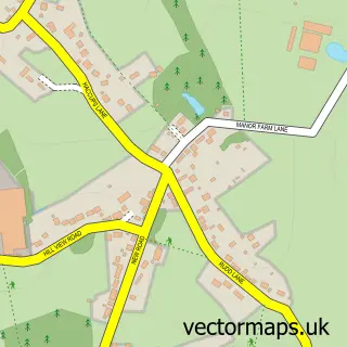
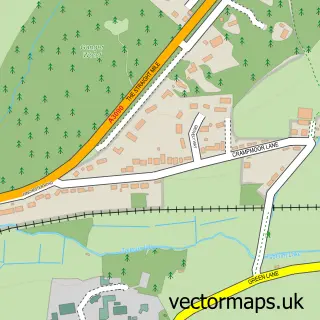
This Timsbury street map is a detailed vector street map covering a 750m x 750m area. Select a larger area to create and download your own vector street map of Timsbury.
The 750-metre map sample for Timsbury covers 121 mapped buildings and approximately 5.3 km of road detail, of which 5 named roads are named. The immediate area includes 1 pub and 3 MOT stations within 2 miles. The wider area around Timsbury features 1 tourism point of interest and 1 food and drink venue. To create a larger or custom map of Timsbury, the map builder lets you define your own coverage area and download editable SVG, PDF and PNG files.
Create a larger editable map of Timsbury
Choose any area you need and generate a high-quality vector map instantly. Perfect for print, planning, design, business and personal use.

This Timsbury street map in Hampshire is available as downloadable SVG, PDF and PNG map files, or as a printed map for planning, business, display, education, local information and design work. You can also create a larger custom map area using the map selector.
What this Timsbury map sample shows
Timsbury lies within Michelmersh And Timsbury Cp parish, part of Ampfield & Braishfield ward in the Test Valley District local authority area. The postcode geography for this area includes the SO postcode area, the SO51 postcode district and the SO51 0 postcode sector. Residents fall under the Nhs Hampshire And Isle Of Wight Integrated Care Board for NHS services.
Local features near Timsbury
Within 2 milesAmenities and services in and around Timsbury.
Administrative and postcode information for Timsbury
The local authority covering Timsbury is Test Valley District, within the county of Hampshire. The settlement lies within Ampfield & Braishfield ward and Michelmersh And Timsbury Cp civil parish. The SO51 postcode district and SO51 0 postcode sector serve the immediate area. NHS provision in the area is delivered through Hampshire Hospitals Nhs Foundation Trust.
Nearby street map samples around Timsbury


More street maps in Hampshire
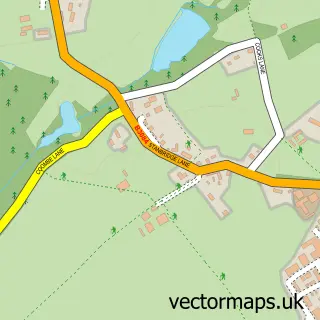
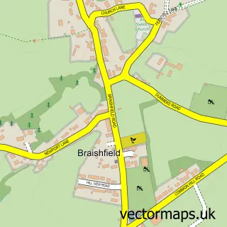
750 metre map area coverage
Boundary, postcode and point of interest information for the 750m x 750m rectangle centred on this sample map.
Boundaries containing map centre
Constituency: Romsey and Southampton North Co Const
County: Hampshire County
District: Test Valley District
Icb: NHS Hampshire and Isle of Wight ICB
Parish: Michelmersh and Timsbury CP
Police Force: hampshire
Postcode District: SO51
Postcode Sector: SO51 0
Ward: Blackwater Ward
Nearby boundaries intersecting sample
Ward: Ampfield & Braishfield Ward
Postcode coverage
POI category counts
Automotive Dealer: 1
Automotive Repair: 1
Community Center: 1
Gastropub: 1
Janitorial Services: 1
Park: 1
Paving Contractor: 1
Pub: 1
Public And Government Association: 1
Sample points of interest
- Winterslow Carriage Company
- Wessex Towbar Services
- Jubilee Hall
- The Malthouse (Gastro Pub)
- 5 Star Cleaning
- Hunts Farm Sports Ground
- J R Moore & Sons
- The Goat
- Michelmersh & Timsbury Parish Council
Create a larger editable map of Timsbury
This sample shows only a 750 metre area. To create a larger map of Timsbury, use our map builder to choose your own coverage area, add titles and download editable SVG, PDF and PNG files.
Create a custom map of Timsbury