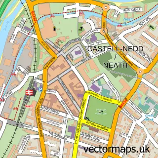
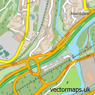
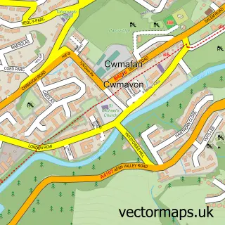
This Ton-Mawr street map is a detailed vector street map covering a 750m x 750m area. Select a larger area to create and download your own vector street map of Ton-Mawr.
The 750-metre map sample for Ton-Mawr covers 100 mapped buildings and approximately 9.6 km of road detail, of which 6 named roads are named. The immediate area includes 1 MOT station. To create a larger or custom map of Ton-Mawr, the map builder lets you define your own coverage area and download editable SVG, PDF and PNG files.
Create a larger editable map of Ton-Mawr
Choose any area you need and generate a high-quality vector map instantly. Perfect for print, planning, design, business and personal use.

This Ton-Mawr street map in West Glamorgan is available as downloadable SVG, PDF and PNG map files, or as a printed map for planning, business, display, education, local information and design work. You can also create a larger custom map area using the map selector.
What this Ton-Mawr map sample shows
Ton-Mawr lies within Pelenna Community parish, part of Pelenna ward in the Castell-Nedd Port Talbot - Neath Port Talbot local authority area. The postcode geography for this area includes the SA postcode area, the SA12 postcode district and the SA12 9 postcode sector. Residents fall under the Swansea Bay University Local Health Board for NHS services.
Local features near Ton-Mawr
Within 2 milesAmenities and services in and around Ton-Mawr.
Administrative and postcode information for Ton-Mawr
The local authority covering Ton-Mawr is Castell-Nedd Port Talbot - Neath Port Talbot, within the county of West Glamorgan. The settlement lies within Pelenna ward and Pelenna Community civil parish. The SA12 postcode district and SA12 9 postcode sector serve the immediate area. NHS provision in the area is delivered through Swansea Bay University Health Board.
Nearby street map samples around Ton-Mawr

More street maps in West Glamorgan
750 metre map area coverage
Boundary, postcode and point of interest information for the 750m x 750m rectangle centred on this sample map.
Boundaries containing map centre
Constituency: Aberafan Maesteg Co Const
District: Castell-nedd Port Talbot - Neath Port Talbot
Icb: Abertawe Bro Morgannwg University
Parish: Pelenna Community
Police Force: south wales
Postcode District: SA12
Postcode Sector: SA12 9
Nearby boundaries intersecting sample
No additional intersecting boundaries found.
Postcode coverage
POI category counts
Automotive Repair: 1
Church Cathedral: 1
Cleaning Services: 1
Elementary School: 1
Fabric Store: 1
Furniture Store: 1
Pop Up Shop: 1
Professional Services: 1
Sports Club And League: 1
Sample points of interest
- Crompton autos
- St teilo Church Tonmawr
- RHB Drain Services
- Tonmawr Primary School
- Pelenna Patchworks
- Shazam Furniture
- Tonmawr Christmas Tree Farm
- Jenny B Photography
- Tonmawr RFC
Create a larger editable map of Ton-Mawr
This sample shows only a 750 metre area. To create a larger map of Ton-Mawr, use our map builder to choose your own coverage area, add titles and download editable SVG, PDF and PNG files.
Create a custom map of Ton-Mawr