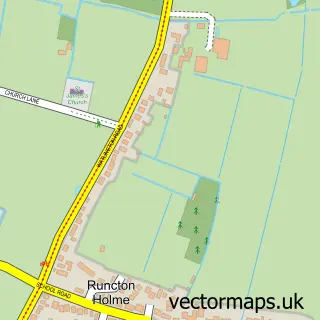
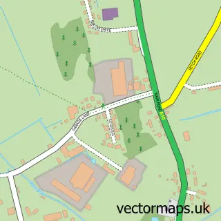
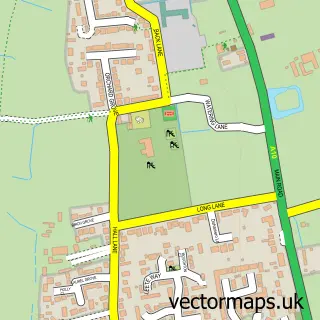
This Tottenhill street map is a detailed vector street map covering a 750m x 750m area. Select a larger area to create and download your own vector street map of Tottenhill.
The 750-metre map sample for Tottenhill covers 81 mapped buildings and approximately 10.7 km of road detail, of which 4 named roads are named. The immediate area includes 1 GP surgery within 2 miles and 1 MOT station within 2 miles. To create a larger or custom map of Tottenhill, the map builder lets you define your own coverage area and download editable SVG, PDF and PNG files.
Create a larger editable map of Tottenhill
Choose any area you need and generate a high-quality vector map instantly. Perfect for print, planning, design, business and personal use.

This Tottenhill street map in Norfolk is available as downloadable SVG, PDF and PNG map files, or as a printed map for planning, business, display, education, local information and design work. You can also create a larger custom map area using the map selector.
What this Tottenhill map sample shows
Tottenhill lies within Tottenhill Cp parish, part of Watlington ward in the King's Lynn And West Norfolk District (B) local authority area. The postcode geography for this area includes the PE postcode area, the PE33 postcode district and the PE33 0 postcode sector. Residents fall under the Nhs Norfolk And Waveney Integrated Care Board for NHS services.
Local features near Tottenhill
Within 2 milesAmenities and services in and around Tottenhill.
Administrative and postcode information for Tottenhill
Tottenhill lies within Tottenhill Cp parish, part of Watlington ward in the King's Lynn And West Norfolk District (B) local authority area. The postcode geography for this area includes the PE postcode area, the PE33 postcode district and the PE33 0 postcode sector. Residents fall under the Nhs Norfolk And Waveney Integrated Care Board for NHS services.
Nearby street map samples around Tottenhill

More street maps in Norfolk
750 metre map area coverage
Boundary, postcode and point of interest information for the 750m x 750m rectangle centred on this sample map.
Boundaries containing map centre
Constituency: South West Norfolk Co Const
County: Norfolk County
District: King's Lynn and West Norfolk District (B)
Icb: NHS Norfolk and Waveney ICB
Parish: Tottenhill CP
Police Force: norfolk
Postcode District: PE33
Postcode Sector: PE33 0
Ward: Watlington Ward
Nearby boundaries intersecting sample
Parish: Watlington CP
Postcode coverage
POI category counts
Antique Store: 2
Advertising Agency: 1
Auto Body Shop: 1
Automotive Dealer: 1
Automotive Repair: 1
Business Manufacturing And Supply: 1
Car Dealer: 1
Furniture Store: 1
Garbage Collection Service: 1
Home Decor: 1
Sample points of interest
- Stevenson Skip Hire
- Jubilee Antiques
- Jubilee Antiques
- On Site Repairs
- The Historic Sportscar Collection
- Steve Cato Restorations
- AH Windows and Doors
- Pd Car Sales
- Classic Carpet Co
- Circle Waste
- Unique Gifts & Interiors
- Leadsy
Create a larger editable map of Tottenhill
This sample shows only a 750 metre area. To create a larger map of Tottenhill, use our map builder to choose your own coverage area, add titles and download editable SVG, PDF and PNG files.
Create a custom map of Tottenhill