This Trefnant street map is a detailed vector street map covering a 750m x 750m area. Select a larger area to create and download your own vector street map of Trefnant.
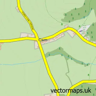
The 750-metre map sample for Trefnant covers 221 mapped buildings and approximately 10.0 km of road detail, of which 16 named roads are named. The immediate area includes 1 school and 2 pubs. The wider area around Trefnant features 3 food and drink venues and 1 campsite within 2 miles. To create a larger or custom map of Trefnant, the map builder lets you define your own coverage area and download editable SVG, PDF and PNG files.
Create a larger editable map of Trefnant
Choose any area you need and generate a high-quality vector map instantly. Perfect for print, planning, design, business and personal use.

This Trefnant street map in Clwyd is available as downloadable SVG, PDF and PNG map files, or as a printed map for planning, business, display, education, local information and design work. You can also create a larger custom map area using the map selector.
What this Trefnant map sample shows
Trefnant lies within Trefnant Community parish, part of Trefnant ward in the Sir Ddinbych - Denbighshire local authority area. The postcode geography for this area includes the LL postcode area, the LL16 postcode district and the LL16 4 postcode sector. Residents fall under the Betsi Cadwaladr University Health Board for NHS services.
Local features near Trefnant
Within 2 milesAmenities and services in and around Trefnant.
Administrative and postcode information for Trefnant
The local authority covering Trefnant is Sir Ddinbych - Denbighshire, within the county of Clwyd. The settlement lies within Trefnant ward and Trefnant Community civil parish. The LL16 postcode district and LL16 4 postcode sector serve the immediate area. NHS provision in the area is delivered through Betsi Cadwaladr University Health Board.
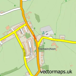
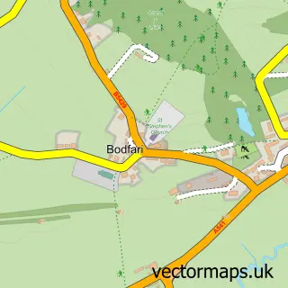
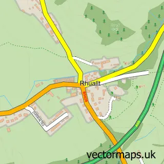
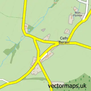
Nearby street map samples around Trefnant
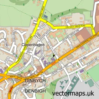

More street maps in Clwyd
750 metre map area coverage
Boundary, postcode and point of interest information for the 750m x 750m rectangle centred on this sample map.
Boundaries containing map centre
Constituency: Clwyd North Co Const
District: Sir Ddinbych - Denbighshire
Icb: Betsi Cadwaladr University
Parish: Trefnant Community
Police Force: north wales
Postcode District: LL16
Postcode Sector: LL16 5
Nearby boundaries intersecting sample
Postcode District: LL17
Postcode Sector: LL16 4, LL17 0
Postcode coverage
POI category counts
Pub: 2
Retirement Home: 2
Assisted Living Facility: 1
Beauty And Spa: 1
Caterer: 1
Church Cathedral: 1
Coffee Shop: 1
Community Center: 1
Education: 1
Elementary School: 1
Sample points of interest
- Old Rectory Residential Home
- Country Beauty
- Strand Catering
- Holy Trinity Church
- The Crossroads Cafe Trefnant
- Trefnant Village Hall
- Ysgol Trefnant
- Trefnant Voluntary Aided
- HVAC Recruitment
- Trefnant Chip Shop
- Village Hall Fishing Pond
- The Hair Lounge
Create a larger editable map of Trefnant
This sample shows only a 750 metre area. To create a larger map of Trefnant, use our map builder to choose your own coverage area, add titles and download editable SVG, PDF and PNG files.
Create a custom map of Trefnant