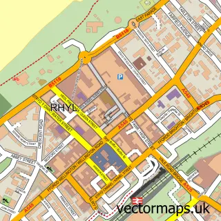
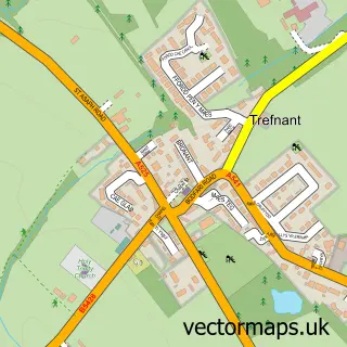
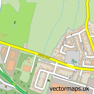
This St Asaph street map is a detailed vector street map covering a 750m x 750m area. Select a larger area to create and download your own vector street map of St Asaph.
The 750-metre map sample for St Asaph covers 397 mapped buildings and approximately 13.7 km of road detail, of which 32 named roads are named. The immediate area includes 2 schools, 1 GP surgery, 1 pub and 1 MOT station, with 2 within 2 miles. The wider area around St Asaph features 2 tourism points of interest, 6 food and drink venues and 1 hotel. To create a larger or custom map of St Asaph, the map builder lets you define your own coverage area and download editable SVG, PDF and PNG files.
Create a larger editable map of St Asaph
Choose any area you need and generate a high-quality vector map instantly. Perfect for print, planning, design, business and personal use.

This St Asaph street map in Clwyd is available as downloadable SVG, PDF and PNG map files, or as a printed map for planning, business, display, education, local information and design work. You can also create a larger custom map area using the map selector.
What this St Asaph map sample shows
St Asaph lies within Bodelwyddan Community parish, part of Bodelwyddan ward in the Sir Ddinbych - Denbighshire local authority area. The postcode geography for this area includes the LL postcode area, the LL18 postcode district and the LL18 5 postcode sector. Residents fall under the Betsi Cadwaladr University Health Board for NHS services.
Local features near St Asaph
Within 2 milesAmenities and services in and around St Asaph.
Administrative and postcode information for St Asaph
The local authority covering St Asaph is Sir Ddinbych - Denbighshire, within the county of Clwyd. The settlement lies within Bodelwyddan ward and Bodelwyddan Community civil parish. The LL18 postcode district and LL18 5 postcode sector serve the immediate area. NHS provision in the area is delivered through Betsi Cadwaladr University Health Board.
Nearby street map samples around St Asaph
More street maps in Clwyd
750 metre map area coverage
Boundary, postcode and point of interest information for the 750m x 750m rectangle centred on this sample map.
Boundaries containing map centre
Constituency: Clwyd North Co Const
District: Sir Ddinbych - Denbighshire
Icb: Betsi Cadwaladr University
Parish: St. Asaph Community
Police Force: north wales
Postcode District: LL17
Postcode Sector: LL17 0
Nearby boundaries intersecting sample
No additional intersecting boundaries found.
Postcode coverage
POI category counts
Beauty Salon: 4
Convenience Store: 4
Barber: 3
Chiropractor: 3
Atms: 2
Beauty And Spa: 2
Beauty Product Supplier: 2
Books Mags Music And Video: 2
Coffee Shop: 2
Contractor: 2
Sample points of interest
- Salisbury & Co Accountants
- Fat Lads KickAbout
- St Asaph Cathedral
- Kentigern Gallery
- Earthworks Pottery
- Natwest
- PayPoint
- Ces Electrotech
- LNS Fountain Garages
- Moore Manor Garage, Trefnant
- Rachel City glam Barbers
- Scissor Trix
Create a larger editable map of St Asaph
This sample shows only a 750 metre area. To create a larger map of St Asaph, use our map builder to choose your own coverage area, add titles and download editable SVG, PDF and PNG files.
Create a custom map of St Asaph