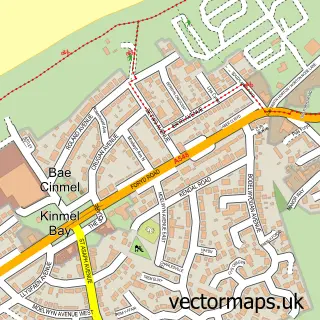
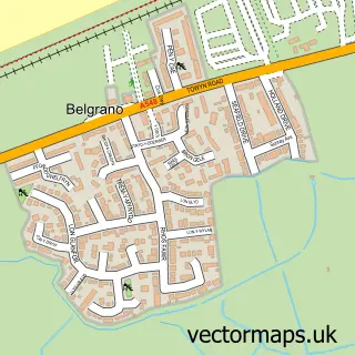
This Bodelwyddan street map is a detailed vector street map covering a 750m x 750m area. Select a larger area to create and download your own vector street map of Bodelwyddan.
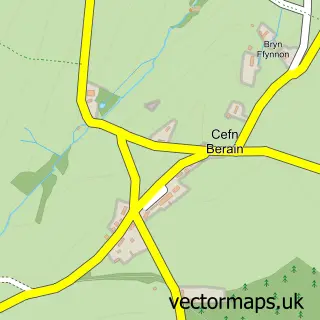
The 750-metre map sample for Bodelwyddan covers 209 mapped buildings and approximately 13.9 km of road detail, of which 15 named roads are named. The immediate area includes 1 school and 1 MOT station, with 6 within 2 miles. The wider area around Bodelwyddan features 4 food and drink venues. To create a larger or custom map of Bodelwyddan, the map builder lets you define your own coverage area and download editable SVG, PDF and PNG files.
Create a larger editable map of Bodelwyddan
Choose any area you need and generate a high-quality vector map instantly. Perfect for print, planning, design, business and personal use.

This Bodelwyddan street map in Clwyd is available as downloadable SVG, PDF and PNG map files, or as a printed map for planning, business, display, education, local information and design work. You can also create a larger custom map area using the map selector.
What this Bodelwyddan map sample shows
Bodelwyddan lies within Bodelwyddan Community parish, part of Bodelwyddan ward in the Sir Ddinbych - Denbighshire local authority area. The postcode geography for this area includes the LL postcode area, the LL18 postcode district and the LL18 5 postcode sector. Residents fall under the Betsi Cadwaladr University Health Board for NHS services.
Local features near Bodelwyddan
Within 2 milesAmenities and services in and around Bodelwyddan.
Administrative and postcode information for Bodelwyddan
Bodelwyddan lies within Bodelwyddan Community parish, part of Bodelwyddan ward in the Sir Ddinbych - Denbighshire local authority area. The postcode geography for this area includes the LL postcode area, the LL18 postcode district and the LL18 5 postcode sector. Residents fall under the Betsi Cadwaladr University Health Board for NHS services.
Nearby street map samples around Bodelwyddan

More street maps in Clwyd
750 metre map area coverage
Boundary, postcode and point of interest information for the 750m x 750m rectangle centred on this sample map.
Boundaries containing map centre
Constituency: Clwyd North Co Const
District: Sir Ddinbych - Denbighshire
Icb: Betsi Cadwaladr University
Parish: Bodelwyddan Community
Police Force: north wales
Postcode District: LL18
Postcode Sector: LL18 5
Nearby boundaries intersecting sample
No additional intersecting boundaries found.
Postcode coverage
POI category counts
Convenience Store: 4
Cafe: 3
Elementary School: 2
Professional Services: 2
Atms: 1
Automotive: 1
British Restaurant: 1
Business: 1
Business Management Services: 1
Chinese Restaurant: 1
Sample points of interest
- PayPoint
- M Thomas Caravan Repairs
- Eat at the Green
- JM Renewables Solutions
- Principality Consulting
- C and T Cafe and Bistro
- Kinmel Park Services Westbound
- Penny's Cafe
- Lucky Phoenix
- J M Renewable Solutions Ltd.
- Premier Premier Stores
- SPAR
Create a larger editable map of Bodelwyddan
This sample shows only a 750 metre area. To create a larger map of Bodelwyddan, use our map builder to choose your own coverage area, add titles and download editable SVG, PDF and PNG files.
Create a custom map of Bodelwyddan