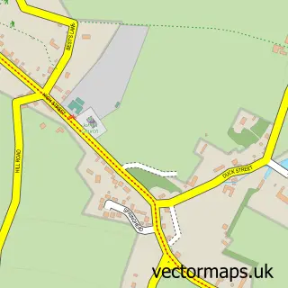
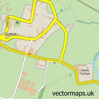
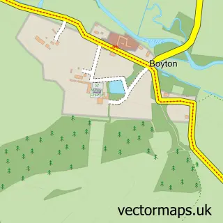
This Tytherington street map is a detailed vector street map covering a 750m x 750m area. Select a larger area to create and download your own vector street map of Tytherington.
The 750-metre map sample for Tytherington covers 63 mapped buildings and approximately 7.8 km of road detail. The immediate area includes 1 MOT station within 2 miles. The wider area around Tytherington features 1 tourism point of interest and 1 campsite within 2 miles. To create a larger or custom map of Tytherington, the map builder lets you define your own coverage area and download editable SVG, PDF and PNG files.
Create a larger editable map of Tytherington
Choose any area you need and generate a high-quality vector map instantly. Perfect for print, planning, design, business and personal use.

This Tytherington street map in Wiltshire is available as downloadable SVG, PDF and PNG map files, or as a printed map for planning, business, display, education, local information and design work. You can also create a larger custom map area using the map selector.
What this Tytherington map sample shows
Tytherington lies within Heytesbury Cp parish, part of Warminster Copheap And Wylye ward in the Wiltshire local authority area. The postcode geography for this area includes the BA postcode area, the BA12 postcode district and the BA12 7 postcode sector. Residents fall under the Nhs Bath And North East Somerset, Swindon And Wiltshire Integrated Care Board for NHS services.
Local features near Tytherington
Within 2 milesAmenities and services in and around Tytherington.
Administrative and postcode information for Tytherington
The local authority covering Tytherington is Wiltshire, within the county of Wiltshire. The settlement lies within Warminster Copheap And Wylye ward and Heytesbury Cp civil parish. The BA12 postcode district and BA12 7 postcode sector serve the immediate area. NHS provision in the area is delivered through Salisbury Nhs Foundation Trust.
Nearby street map samples around Tytherington

More street maps in Wiltshire
750 metre map area coverage
Boundary, postcode and point of interest information for the 750m x 750m rectangle centred on this sample map.
Boundaries containing map centre
Constituency: South West Wiltshire Co Const
District: Wiltshire
Icb: NHS Bath and North East Somerset Swindon and Wiltshire ICB
Parish: Sutton Veny CP
Police Force: wiltshire
Postcode District: BA12
Postcode Sector: BA12 7
Nearby boundaries intersecting sample
Parish: Heytesbury CP
Postcode coverage
POI category counts
Anglican Church: 1
Beauty Salon: 1
Bicycle Shop: 1
Cabin: 1
Cosmetology School: 1
Equestrian Facility: 1
Horse Boarding: 1
Landmark And Historical Building: 1
Sports Club And League: 1
Sample points of interest
- Tytherington: St James
- Beauty Retreat
- Route 24 Cycles
- St James Court
- Olive Training, Beauty, Makeup & Holistic Therapy Courses
- Downlands Equestrian
- Simon Earle Racing
- Tytherington, Wiltshire
- Hackney Horse Society
Create a larger editable map of Tytherington
This sample shows only a 750 metre area. To create a larger map of Tytherington, use our map builder to choose your own coverage area, add titles and download editable SVG, PDF and PNG files.
Create a custom map of Tytherington