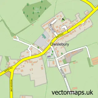
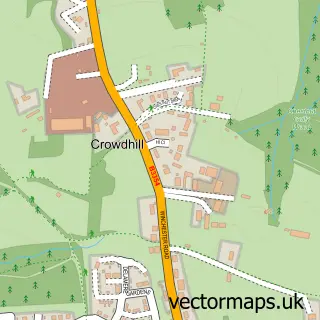
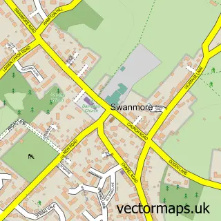
This Upham street map is a detailed vector street map covering a 750m x 750m area. Select a larger area to create and download your own vector street map of Upham.
The 750-metre map sample for Upham covers 99 mapped buildings and approximately 12.5 km of road detail, of which 7 named roads are named. The immediate area includes 1 pub. The wider area around Upham features 1 tourism point of interest, 1 food and drink venue and 1 hotel. To create a larger or custom map of Upham, the map builder lets you define your own coverage area and download editable SVG, PDF and PNG files.
Create a larger editable map of Upham
Choose any area you need and generate a high-quality vector map instantly. Perfect for print, planning, design, business and personal use.

This Upham street map in Hampshire is available as downloadable SVG, PDF and PNG map files, or as a printed map for planning, business, display, education, local information and design work. You can also create a larger custom map area using the map selector.
What this Upham map sample shows
Upham lies within Upham Cp parish, part of Upper Meon Valley ward in the Winchester District (B) local authority area. The postcode geography for this area includes the SO postcode area, the SO32 postcode district and the SO32 1 postcode sector. Residents fall under the Nhs Hampshire And Isle Of Wight Integrated Care Board for NHS services.
Local features near Upham
Within 2 milesAmenities and services in and around Upham.
Administrative and postcode information for Upham
The local authority covering Upham is Winchester District (B), within the county of Hampshire. The settlement lies within Upper Meon Valley ward and Upham Cp civil parish. The SO32 postcode district and SO32 1 postcode sector serve the immediate area. NHS provision in the area is delivered through Hampshire Hospitals Nhs Foundation Trust.
Nearby street map samples around Upham

More street maps in Hampshire
750 metre map area coverage
Boundary, postcode and point of interest information for the 750m x 750m rectangle centred on this sample map.
Boundaries containing map centre
Constituency: Winchester Co Const
County: Hampshire County
District: Winchester District (B)
Icb: NHS Hampshire and Isle of Wight ICB
Parish: Upham CP
Police Force: hampshire
Postcode District: SO32
Postcode Sector: SO32 1
Ward: Upper Meon Valley Ward
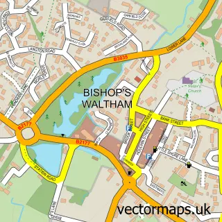
Nearby boundaries intersecting sample
Parish: Bishops Waltham CP
Ward: Bishop's Waltham Ward
Postcode coverage
POI category counts
Beauty Salon: 2
Anglican Church: 1
Construction Services: 1
Elementary School: 1
Hotel: 1
Information Technology Company: 1
Park: 1
Permanent Makeup: 1
Plumbing: 1
Pub: 1
Sample points of interest
- Blessed Mary, Upham
- Debbie Collins Permanent Cosmetics
- The Retreat Upham
- The Honest Builder
- Upham C of E Primary School
- Upham Inns
- Sugar Web Development
- Upham Park
- Debbie Collins - Permanent Cosmetics & Beauty
- Cathedral Plumbing And Heating
- The Brushmakers Arms
- Twinkleberry
Create a larger editable map of Upham
This sample shows only a 750 metre area. To create a larger map of Upham, use our map builder to choose your own coverage area, add titles and download editable SVG, PDF and PNG files.
Create a custom map of Upham