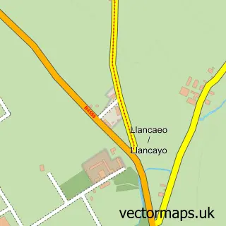
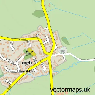
This Usk street map is a detailed vector street map covering a 750m x 750m area. Select a larger area to create and download your own vector street map of Usk.
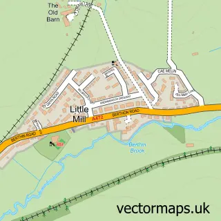
The 750-metre map sample for Usk covers 353 mapped buildings and approximately 40.8 km of road detail, of which 28 named roads are named. The immediate area includes 1 school, 6 pubs and 1 MOT station, with 2 within 2 miles. The wider area around Usk features 6 tourism points of interest, 15 food and drink venues and 2 hotels. To create a larger or custom map of Usk, the map builder lets you define your own coverage area and download editable SVG, PDF and PNG files.
Create a larger editable map of Usk
Choose any area you need and generate a high-quality vector map instantly. Perfect for print, planning, design, business and personal use.

This Usk street map in Gwent is available as downloadable SVG, PDF and PNG map files, or as a printed map for planning, business, display, education, local information and design work. You can also create a larger custom map area using the map selector.
What this Usk map sample shows
Usk lies within Usk Community parish, part of Usk ward in the Sir Fynwy - Monmouthshire local authority area. The postcode geography for this area includes the NP postcode area, the NP15 postcode district and the NP15 1 postcode sector. Residents fall under the Aneurin Bevan University Health Board for NHS services.
Local features near Usk
Within 2 milesAmenities and services in and around Usk.
Administrative and postcode information for Usk
The local authority covering Usk is Sir Fynwy - Monmouthshire, within the county of Gwent. The settlement lies within Usk ward and Usk Community civil parish. The NP15 postcode district and NP15 1 postcode sector serve the immediate area. NHS provision in the area is delivered through Aneurin Bevan University Health Board.
Nearby street map samples around Usk

More street maps in Gwent
750 metre map area coverage
Boundary, postcode and point of interest information for the 750m x 750m rectangle centred on this sample map.
Boundaries containing map centre
Constituency: Monmouthshire Co Const
District: Sir Fynwy - Monmouthshire
Icb: Aneurin Bevan University
Parish: Usk Community
Police Force: gwent
Postcode District: NP15
Postcode Sector: NP15 1
Nearby boundaries intersecting sample
Parish: Llanbadoc Community
Postcode coverage
POI category counts
Real Estate Agent: 8
Financial Service: 6
Pub: 6
Beauty Salon: 5
Flowers And Gifts Shop: 5
Hair Salon: 5
Restaurant: 5
Convenience Store: 4
Shopping: 4
Professional Services: 3
Sample points of interest
- AIMS Accountants For Business - Neil Williams
- Paul Munson & Co
- GX Group
- St Marys Church
- U.S.K Emporium
- Reeks Stained Glass & Crafts
- The Cooperative Food Usk - Bridge Street (SWAP)
- Car Care
- Station Garage Usk
- Parsons Bakery
- Monmouthshire Building Society Usk Agency
- Barclays Bank
Create a larger editable map of Usk
This sample shows only a 750 metre area. To create a larger map of Usk, use our map builder to choose your own coverage area, add titles and download editable SVG, PDF and PNG files.
Create a custom map of Usk