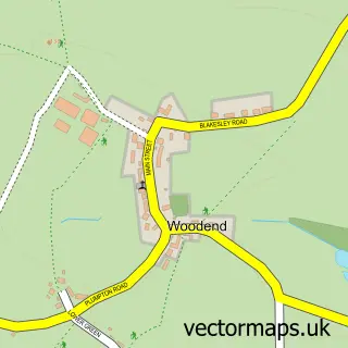
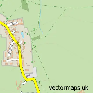
This Wappenham street map is a detailed vector street map covering a 750m x 750m area. Select a larger area to create and download your own vector street map of Wappenham.
The 750-metre map sample for Wappenham covers 111 mapped buildings and approximately 9.3 km of road detail, of which 9 named roads are named. To create a larger or custom map of Wappenham, the map builder lets you define your own coverage area and download editable SVG, PDF and PNG files.
Create a larger editable map of Wappenham
Choose any area you need and generate a high-quality vector map instantly. Perfect for print, planning, design, business and personal use.

This Wappenham street map in Northamptonshire is available as downloadable SVG, PDF and PNG map files, or as a printed map for planning, business, display, education, local information and design work. You can also create a larger custom map area using the map selector.
What this Wappenham map sample shows
Wappenham lies within Wappenham Cp parish, part of Washington ward in the West Northamptonshire local authority area. The postcode geography for this area includes the NN postcode area, the NN12 postcode district and the NN12 8 postcode sector. Residents fall under the Nhs Northamptonshire Integrated Care Board for NHS services.
Local features near Wappenham
Within 2 milesAmenities and services in and around Wappenham.
Administrative and postcode information for Wappenham
The local authority covering Wappenham is West Northamptonshire, within the county of Northamptonshire. The settlement lies within Washington ward and Wappenham Cp civil parish. The NN12 postcode district and NN12 8 postcode sector serve the immediate area. NHS provision in the area is delivered through Northampton General Hospital Nhs Trust.
Nearby street map samples around Wappenham

More street maps in Northamptonshire
750 metre map area coverage
Boundary, postcode and point of interest information for the 750m x 750m rectangle centred on this sample map.
Boundaries containing map centre
Constituency: South Northamptonshire Co Const
District: West Northamptonshire
Icb: NHS Northamptonshire ICB
Parish: Wappenham CP
Police Force: northamptonshire
Postcode District: NN12
Postcode Sector: NN12 8
Ward: Rural South Northamptonshire Ward
Nearby boundaries intersecting sample
No additional intersecting boundaries found.
Postcode coverage
POI category counts
Contractor: 2
Security Systems: 2
Anglican Church: 1
Appliance Manufacturer: 1
Automotive Repair: 1
Automotive Services And Repair: 1
Bed And Breakfast: 1
Caterer: 1
Charity Organization: 1
Event Planning: 1
Sample points of interest
- St Mary the Virgin, Wappenham
- Richard Owen Design & Engineering
- R J Abbott & Son
- Infolytica
- The Cowshed Bed And Breakfast
- Robbies Hogroasts & Bbq's
- The PSP Association
- Beespoke Design
- F King & Sons Builders
- Rectory Farm - Wedding & Events Venue
- Wappenham Farm
- DJ Marquees
Create a larger editable map of Wappenham
This sample shows only a 750 metre area. To create a larger map of Wappenham, use our map builder to choose your own coverage area, add titles and download editable SVG, PDF and PNG files.
Create a custom map of Wappenham