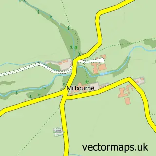
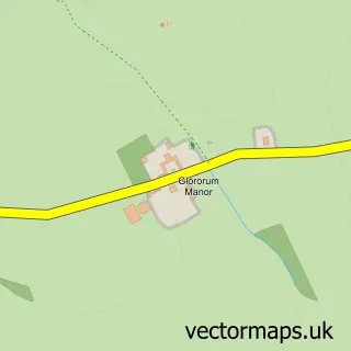
This Whalton street map is a detailed vector street map covering a 750m x 750m area. Select a larger area to create and download your own vector street map of Whalton.
The 750-metre map sample for Whalton covers 81 mapped buildings and approximately 15.7 km of road detail, of which 1 named road are named. The immediate area includes 1 school and 1 pub. The wider area around Whalton features 1 tourism point of interest, 1 food and drink venue and 1 hotel. To create a larger or custom map of Whalton, the map builder lets you define your own coverage area and download editable SVG, PDF and PNG files.
Create a larger editable map of Whalton
Choose any area you need and generate a high-quality vector map instantly. Perfect for print, planning, design, business and personal use.

This Whalton street map in Northumberland is available as downloadable SVG, PDF and PNG map files, or as a printed map for planning, business, display, education, local information and design work. You can also create a larger custom map area using the map selector.
What this Whalton map sample shows
Whalton lies within Whalton Cp parish, part of Ponteland East And Stannington ward in the Northumberland local authority area. The postcode geography for this area includes the NE postcode area, the NE61 postcode district and the NE61 3 postcode sector. Residents fall under the Nhs North East And North Cumbria Integrated Care Board for NHS services.
Local features near Whalton
Within 2 milesAmenities and services in and around Whalton.
Administrative and postcode information for Whalton
Whalton lies within Whalton Cp parish, part of Ponteland East And Stannington ward in the Northumberland local authority area. The postcode geography for this area includes the NE postcode area, the NE61 postcode district and the NE61 3 postcode sector. Residents fall under the Nhs North East And North Cumbria Integrated Care Board for NHS services.
Nearby street map samples around Whalton

More street maps in Northumberland
750 metre map area coverage
Boundary, postcode and point of interest information for the 750m x 750m rectangle centred on this sample map.
Boundaries containing map centre
Constituency: Hexham Co Const
District: Northumberland
Icb: NHS North East and North Cumbria ICB
Parish: Whalton CP
Police Force: northumberland
Postcode District: NE61
Postcode Sector: NE61 3
Nearby boundaries intersecting sample
No additional intersecting boundaries found.
Postcode coverage
POI category counts
Post Office: 2
Anglican Church: 1
Church Cathedral: 1
Community Center: 1
Community Services Non Profits: 1
Drywall Services: 1
Hotel: 1
Landmark And Historical Building: 1
Preschool: 1
Pub: 1
Sample points of interest
- St Mary Magdalene
- St Mary the Virgin Church
- Whalton Village Hall
- St Marys Toddler Group
- Nick Howey Stonewalling
- Tile Sheds Holiday Cottage
- Whalton Manor Gardens
- Post Office-Whalton
- Whalton Post Office
- PAWS Preschool and After School Club at Whalton School
- The Beresford Arms
- Overland Adventures
Create a larger editable map of Whalton
This sample shows only a 750 metre area. To create a larger map of Whalton, use our map builder to choose your own coverage area, add titles and download editable SVG, PDF and PNG files.
Create a custom map of Whalton