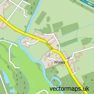
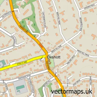
This Whiteley Village street map is a detailed vector street map covering a 750m x 750m area. Select a larger area to create and download your own vector street map of Whiteley Village.
The 750-metre map sample for Whiteley Village covers 160 mapped buildings and approximately 8.8 km of road detail, of which 9 named roads are named. The immediate area includes 2 GP surgeries within 2 miles and 8 MOT stations within 2 miles. To create a larger or custom map of Whiteley Village, the map builder lets you define your own coverage area and download editable SVG, PDF and PNG files.
Create a larger editable map of Whiteley Village
Choose any area you need and generate a high-quality vector map instantly. Perfect for print, planning, design, business and personal use.

This Whiteley Village street map in Surrey is available as downloadable SVG, PDF and PNG map files, or as a printed map for planning, business, display, education, local information and design work. You can also create a larger custom map area using the map selector.
What this Whiteley Village map sample shows
Whiteley Village lies within Surrey County parish, part of Weybridge St George's Hill ward in the Elmbridge District (B) local authority area. The postcode geography for this area includes the KT postcode area, the KT12 postcode district and the KT12 4 postcode sector. Residents fall under the Nhs Surrey Heartlands Integrated Care Board for NHS services.
Local features near Whiteley Village
Within 2 milesAmenities and services in and around Whiteley Village.
Administrative and postcode information for Whiteley Village
Whiteley Village lies within Surrey County parish, part of Weybridge St George's Hill ward in the Elmbridge District (B) local authority area. The postcode geography for this area includes the KT postcode area, the KT12 postcode district and the KT12 4 postcode sector. Residents fall under the Nhs Surrey Heartlands Integrated Care Board for NHS services.
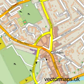
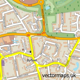
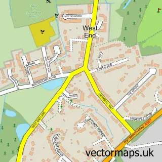
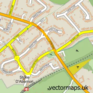
Nearby street map samples around Whiteley Village

More street maps in Surrey
750 metre map area coverage
Boundary, postcode and point of interest information for the 750m x 750m rectangle centred on this sample map.
Boundaries containing map centre
Constituency: Runnymede and Weybridge Co Const
County: Surrey County
District: Elmbridge District (B)
Icb: NHS Surrey and Sussex ICB
Police Force: surrey
Postcode District: KT12
Postcode Sector: KT12 4
Ward: Weybridge St. George's Hill Ward
Nearby boundaries intersecting sample
Postcode District: KT13
Postcode Sector: KT13 0
Postcode coverage
POI category counts
Retirement Home: 3
Shipping Center: 2
Community Services Non Profits: 1
Dance Club: 1
Day Care Preschool: 1
Education: 1
Medical Center: 1
Pet Store: 1
Post Office: 1
Preschool: 1
Sample points of interest
- Whiteley Village
- Pete and G's Rock n Roll Jive Club
- Little Bears - Day Care Limited
- Stagecoach Theatre Arts Weybridge
- Whiteley Village Care Centre
- Pets Corner Seven Hills
- Whiteley Village Post Office
- The Village Nursery School
- Barchester - Burwood Grange Care Home
- Eliza Palmer Care Home
- The Whiteley Homes Trust
- Reeds Weybridge Rugby Football Club
Create a larger editable map of Whiteley Village
This sample shows only a 750 metre area. To create a larger map of Whiteley Village, use our map builder to choose your own coverage area, add titles and download editable SVG, PDF and PNG files.
Create a custom map of Whiteley Village