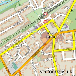
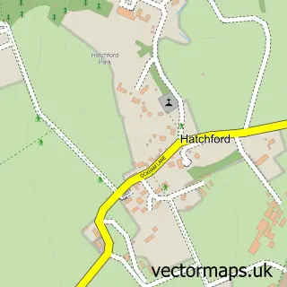
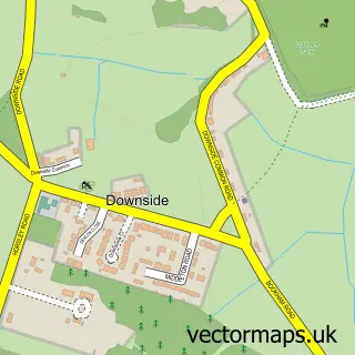
This Byfleet street map is a detailed vector street map covering a 750m x 750m area. Select a larger area to create and download your own vector street map of Byfleet.
The 750-metre map sample for Byfleet covers 437 mapped buildings and approximately 21.9 km of road detail, of which 41 named roads are named. The immediate area includes 3 GP surgeries within 2 miles, 2 pubs and 1 MOT station, with 9 within 2 miles. The wider area around Byfleet features 1 tourism point of interest and 7 food and drink venues. To create a larger or custom map of Byfleet, the map builder lets you define your own coverage area and download editable SVG, PDF and PNG files.
Create a larger editable map of Byfleet
Choose any area you need and generate a high-quality vector map instantly. Perfect for print, planning, design, business and personal use.

This Byfleet street map in Surrey is available as downloadable SVG, PDF and PNG map files, or as a printed map for planning, business, display, education, local information and design work. You can also create a larger custom map area using the map selector.
What this Byfleet map sample shows
Byfleet lies within Surrey County parish, part of Byfleet And West Byfleet ward in the Woking District (B) local authority area. The postcode geography for this area includes the KT postcode area, the KT14 postcode district and the KT14 7 postcode sector. Residents fall under the Nhs Surrey Heartlands Integrated Care Board for NHS services.
Local features near Byfleet
Within 2 milesAmenities and services in and around Byfleet.
Administrative and postcode information for Byfleet
The local authority covering Byfleet is Woking District (B), within the county of Surrey. The settlement lies within Byfleet And West Byfleet ward and Surrey County civil parish. The KT14 postcode district and KT14 7 postcode sector serve the immediate area. NHS provision in the area is delivered through Ashford And St Peter's Hospitals Nhs Foundation Trust.
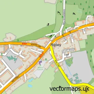
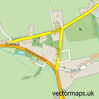
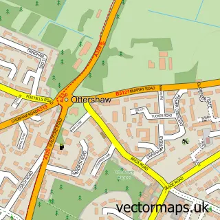
Nearby street map samples around Byfleet

More street maps in Surrey
750 metre map area coverage
Boundary, postcode and point of interest information for the 750m x 750m rectangle centred on this sample map.
Boundaries containing map centre
Constituency: Woking Boro Const
County: Surrey County
District: Woking District (B)
Icb: NHS Surrey and Sussex ICB
Police Force: surrey
Postcode District: KT14
Postcode Sector: KT14 7
Ward: Byfleet & West Byfleet Ward
Nearby boundaries intersecting sample
Constituency: Runnymede and Weybridge Co Const
District: Elmbridge District (B)
Postcode District: KT13
Postcode Sector: KT13 0, KT14 6
Ward: Weybridge St. George's Hill Ward
Postcode coverage
POI category counts
Beauty Salon: 4
Cafe: 4
Chinese Restaurant: 4
Dentist: 4
Fast Food Restaurant: 4
Fireplace Service: 4
Furniture Store: 4
Hair Salon: 4
Indian Restaurant: 4
Automotive Repair: 3
Sample points of interest
- Goalkeeper Training In Surrey
- Binfield Print & Design
- Orange Promotions Ltd
- Your Empowered Self
- C J Mobility
- Basmati Tandoori
- Nisa Local, Byfleet
- The Cooperative Food Byfleet Village High Rd, Byfleet
- Byfleet
- Halfords
- A & N Coachworks
- Byfleet Autocare
Create a larger editable map of Byfleet
This sample shows only a 750 metre area. To create a larger map of Byfleet, use our map builder to choose your own coverage area, add titles and download editable SVG, PDF and PNG files.
Create a custom map of Byfleet