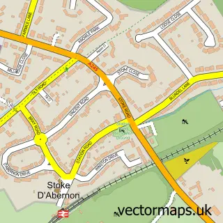
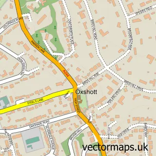
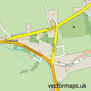
This Cobham street map is a detailed vector street map covering a 750m x 750m area. Select a larger area to create and download your own vector street map of Cobham.
The 750-metre map sample for Cobham covers 407 mapped buildings and approximately 16.6 km of road detail, of which 38 named roads are named. The immediate area includes 1 school, 1 GP surgery within 2 miles, 1 pub and 3 MOT stations within 2 miles. The wider area around Cobham features 2 tourism points of interest, 12 food and drink venues and 3 hotels. To create a larger or custom map of Cobham, the map builder lets you define your own coverage area and download editable SVG, PDF and PNG files.
Create a larger editable map of Cobham
Choose any area you need and generate a high-quality vector map instantly. Perfect for print, planning, design, business and personal use.

This Cobham street map in Surrey is available as downloadable SVG, PDF and PNG map files, or as a printed map for planning, business, display, education, local information and design work. You can also create a larger custom map area using the map selector.
What this Cobham map sample shows
Cobham lies within Surrey County parish, part of Cobham And Downside ward in the Elmbridge District (B) local authority area. The postcode geography for this area includes the KT postcode area, the KT11 postcode district and the KT11 2 postcode sector. Residents fall under the Nhs Surrey Heartlands Integrated Care Board for NHS services.
Local features near Cobham
Within 2 milesAmenities and services in and around Cobham.
Administrative and postcode information for Cobham
Cobham lies within Surrey County parish, part of Cobham And Downside ward in the Elmbridge District (B) local authority area. The postcode geography for this area includes the KT postcode area, the KT11 postcode district and the KT11 2 postcode sector. Residents fall under the Nhs Surrey Heartlands Integrated Care Board for NHS services.
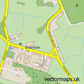
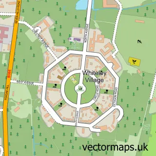
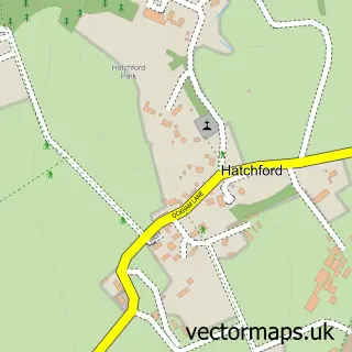
Nearby street map samples around Cobham

More street maps in Surrey
750 metre map area coverage
Boundary, postcode and point of interest information for the 750m x 750m rectangle centred on this sample map.
Boundaries containing map centre
Constituency: Runnymede and Weybridge Co Const
County: Surrey County
District: Elmbridge District (B)
Icb: NHS Surrey and Sussex ICB
Police Force: surrey
Postcode District: KT11
Postcode Sector: KT11 2
Ward: Cobham & Downside Ward
Nearby boundaries intersecting sample
Postcode Sector: KT11 1, KT11 3
Postcode coverage
POI category counts
Real Estate Agent: 17
Clothing Store: 10
Hair Salon: 9
Beauty Salon: 6
Flowers And Gifts Shop: 6
Gym: 6
Bakery: 5
Coffee Shop: 5
Dentist: 5
Dry Cleaning: 5
Sample points of interest
- Accountlets
- Wellden Turnbull
- Avorians Seagulls Tennis Club
- FBH Incite
- Jane Park P R
- Patrick Ross
- The Cobham Clinic
- Clarendon Fine Art
- KISS Kreative
- Pennys of Cobham
- NelBlu Gallery Cowes
- Wislocki Music
Create a larger editable map of Cobham
This sample shows only a 750 metre area. To create a larger map of Cobham, use our map builder to choose your own coverage area, add titles and download editable SVG, PDF and PNG files.
Create a custom map of Cobham